Persistent Coverage, Minimal Logistics
The Vanilla platform delivers multi-day endurance on a single sortie, fundamentally changing the CONOPs for persistent surveillance. A single aircraft can maintain continuous coverage across an area of interest for durations that would typically require multiple platform cycles and associated logistics rotation. This persistence reduces operational complexity, extends ISR availability, and concentrates sensor collections on priority targets without the coordination overhead of fleet management.
The low logistics footprint of small-UAS operations combined with ultra-long-endurance flight enables extended surveillance from austere locations. Extended operations in remote or denied-access areas become feasible with minimal infrastructure support, allowing tactical and strategic ISR teams to focus on mission execution rather than logistics coordination.
AIMS-ISR for Long-Duration Watch
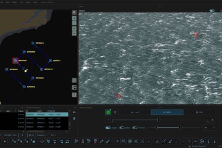
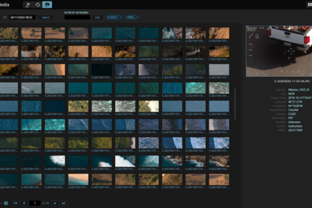
AIMS-ISR sustains operator situational awareness across multi-day sorties by providing a continuous, georeferenced common operating picture. As personnel rotate through extended watch cycles, the unified display maintains mission continuity and ensures all operators work from the same intelligence foundation. Full-mission recording captures the entire surveillance timeline, preserving evidence-grade ISR intelligence for after-action review and strategic analysis.
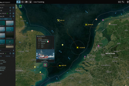
AIMS-C4 distributes the persistent COP to higher command throughout the extended mission duration. Command elements maintain real-time visibility into target areas without requiring dedicated, specialized ground-station infrastructure, enabling ISR dissemination across the enterprise and supporting decision timelines at every echelon.
Mission Profiles
- Long-Endurance ISR: Multi-day coverage from minimal logistics footprint reduces operational complexity and extends availability.
- Maritime and Overland Persistent Surveillance: Continuous sensor presence enables target prosecution and evidence collection over extended observation windows.
- Demonstration and Evaluation: Extended on-station time and low support requirements enable comprehensive operational assessment.