Introduction
Wildfires are becoming more frequent and more destructive, forcing aerial firefighting crews into environments where cloud, fog, or dense embers can obstruct traditional sensors in seconds. Even the most capable EO/IR cameras struggle when visibility is low, and crews can lose much of the situational awareness they depend on to operate safely. In these conditions, decision-making depends less on perfect information and more on having the right information at the right moment.
This guide explores how the integration of Smith Myers’ ARTEMIS mobile phone detection with CarteNav’s AIMS-ISR mission software is incorporated into operations, illustrating how next-generation sensor technology and mission systems work together to better support aerial firefighting crews. By grounding technical concepts in realities shared by operators, it helps airborne firefighting agencies, operators, and technical teams understand not just what these modern systems do, but how they support crews under pressure. It is intended as a practical reference to revisit when incorporating emerging capabilities into operational planning and developing CONOPS.
The insights that follow draw on decades of experience developing mission software in close collaboration with the crews who use it. CarteNav has spent over 20 years developing ISR platforms that continue to evolve to meet real operational demands in aerial firefighting, and the perspectives throughout reflect the learned realities of live deployment, iteration, and continuous feedback from aerial firefighting crews and operators.
Inside this guide
- How mobile-phone detection works when EO/IR visibility is limited
- Using the aircraft as an airborne communications bridge during network outages
- Integrating new sensor data directly into mission workflows
- Improving crew coordination and situational awareness in degraded environments
- Practical considerations for incorporating new capabilities into CONOPS and training
Prefer to read this offline?
Download the full designed PDF for printing, briefing and sharing with your crew.
The ARTEMIS + AIMS-ISR Integrated System
From Detection to Decision
AIMS-ISR is CarteNav’s mission software, built to support operators who regularly make rapid decisions while managing a large volume of information. By consolidating data from multiple sensors into one coherent operating picture, the system reduces cognitive load and simplifies how information is presented. That clarity supports more confident decision-making throughout the mission.
Smith Myers’ ARTEMIS is a mobile phone detection sensor that uses RF technology to detect, locate, and communicate with mobile devices over long ranges. ARTEMIS continues to operate in challenging conditions where other traditional aerial firefighting sensors degrade, providing reliable human-location data and a means of communication when other channels have failed.
By integrating ARTEMIS into AIMS-ISR, mobile phone detections become much more than dots on a map; they become actionable insight. Operators can use the software’s advanced tools alongside mobile phone detection to reduce workload, improve awareness, and support faster, more confident decisions across the entire disaster-response chain.
Operational Advantages of the Integrated System
In real wildfire operations, the value of integration shows up not as features, but as operational advantages crews can rely on in difficult conditions.
Maintaining Awareness in Low-Visibility Conditions
In wildfire response, the difference between uncertainty and action often comes down to one question: where are the people?
ARTEMIS’ RF-based mobile-phone detection delivers a new layer of detection, helping crews gain reliable awareness of where people are even when they cannot be seen by traditional means. That capability becomes more effective still when it is integrated into AIMS-ISR: detections appear within the unified operating picture, alongside geospatial data, alerts, tracks, and other sensor inputs. The operator’s improved awareness of ground conditions increases safety for both civilians and first responders.
Faster Confirmation, Faster Action
When people are in harm’s way, reducing the time between detection and action becomes just as important as detection itself.
AIMS-ISR already reduces mission time by giving operators immediate access to geo-referenced layers, annotations, filters, and alerts. ARTEMIS improves efficiency further by delivering rapid, precise locations, allowing AIMS-ISR to display and pinpoint civilians and first responders faster.
From Information Overload to Operational Focus
The challenge isn’t a lack of information, but paying attention to the right information when everything is happening at once.
Rather than manually managing every sensor, AIMS-ISR provides operators with intuitive, easy-to-customize tools shaped by real field experience. Camera slaving reduces the need to steer sensors, geofencing and custom alerts surface only activity that matters, and decluttering tools suppress low-priority tracks.
Resilient Air-to-Ground Communications
When cell towers fail, communication doesn’t have to.
The integrated system unlocks a new avenue for a critical capability: communication when local networks are down. With ARTEMIS acting as a temporary airborne base station, crews can contact individuals on the ground, relay evacuation routes or muster points, and determine whether a person is unable to evacuate — without depending on cellular networks that routinely collapse during major incidents.
Smith Myers’ ARTEMIS Mobile Phone Detection System
Mobile Phone Detection: Improving Airborne Response
ARTEMIS was designed around the realistic assumption that mobile devices are carried by individuals at all times. With the ability to accurately pinpoint mobile phones — and therefore the people carrying them — operators can quickly assess whether people are present, where they are located, and where they are going. This provides a valuable layer of human-location data that improves the speed and confidence with which aerial firefighting operators make potentially life-saving decisions.
The use of the ARTEMIS mobile phone sensor provides several key advantages.
Precise Human Location
In low-visibility conditions, finding a person can mean the difference between a targeted rescue and a blind search.
During a rescue mission, every second matters. ARTEMIS replaces uncertainty with a pinpoint location, so crews can move directly to those who need help instead of sweeping blindly through hazardous areas.
It also gives operators a live, evolving picture of the people below them at moments when they might otherwise be guessing. The sensor continuously refreshes each phone’s location, turning it into a moving track the crew can act on — whether that means prioritizing a rescue, steering sensors, or confirming that an area is clear.
Wide-Area Coverage: Long Range and 360° Awareness
Large, fast-moving fires demand detection that looks outward in every direction, not just straight down.
ARTEMIS mobile-phone detection extends far beyond the reach of traditional sensors, scanning in all directions with a true 360-degree field of coverage. When a fire is moving fast or the affected area spans miles of difficult terrain, that reach can determine whether a person is detected early or not at all.
The best way I can put it is, imagine you could have a camera that could suddenly see for around 18 nautical miles or 35 kilometers in every direction. Then imagine that camera could see through things like cloud, fire, smoke, in low light conditions, instrumented flying conditions, and be sure that the light or heat signature that the camera’s looking at is a person — and be sure that it’s the actual person you’re looking for. Then the real big shift really is: imagine your camera could then not just do that at that range with that accuracy, it would allow you to communicate with the person.
Andrew Munro, Managing Director, Smith Myers
Safe-to-Drop Speed and Confidence
Hesitation before a drop isn’t about aircraft capability, it’s about certainty on the ground.
ARTEMIS reduces one of the biggest chokepoints in wildfire response: the wait to confirm that no one is within the drop zone. With mobile detection, aerial firefighting aircraft can cut confirmation time and improve suppression efforts.
Restoring Emergency Alerts When Traditional Methods Fail
When cell towers go dark, silence can be as dangerous as the fire itself.
ARTEMIS acts as a temporary airborne base station, allowing crews to send mass emergency warnings, evacuation routes, muster points, and status requests. Individuals can respond to alerts via SMS, or dial 911 to reach the local emergency response team.
Privacy and Regulatory Considerations
ARTEMIS’ communication capabilities were developed with privacy and regulatory considerations in mind. Though data collection requirements vary by country, one principle is universal: during life-threatening emergencies, detection is permitted for the purpose of saving lives. ARTEMIS displays only dots on a map — not identities, nationalities, or personal data. In many jurisdictions, sensor data must be deleted after the mission.
In some situations, responders can also send Search and Rescue Location (SARLOC) messages, allowing individuals to choose whether to share their precise location with firefighting and rescue teams.
Cross-Sensor Fusion: ARTEMIS Complements Existing Capabilities
ARTEMIS mobile phone detection does not replace traditional aerial firefighting sensors; it complements them to provide a more complete operational picture. The sections below explore how ARTEMIS pairs with common airborne sensors, and how those combinations improve operations.
EO/IR + ARTEMIS
Heat signatures detect living things, but in some circumstances distinguishing between livestock and a human is difficult. When a heat signature is picked up by IR sensors and the origin is unknown, a corresponding mobile phone detection helps operators confirm that the signature is a person.
Synthetic Aperture Radar (SAR) + ARTEMIS
Synthetic Aperture Radar outlines terrain, roads, structures, and even the fire edge, giving the aircraft a reliable map to work from. ARTEMIS adds the missing piece: where the people are inside it. When a radar return shows a road cut off by fire or a canyon filling with smoke, a mobile detection layered on top can confirm whether someone is trapped there, moving through the area, or unable to evacuate. In fast-moving, high-risk situations, the combination lets crews know not only where an individual is, but what surrounds them.
Ground Moving Target Indicator (GMTI) + ARTEMIS
GMTI highlights movement on the ground, but it cannot confirm what that movement belongs to. Pairing GMTI with ARTEMIS allows crews to confirm that the movement is human, and provides context clues for what they are doing.
- If ARTEMIS detects an unknown phone and GMTI shows movement from the same location, the crew immediately knows that person is on the move — possibly evacuating, possibly heading into danger.
- If GMTI shows movement but ARTEMIS detects no phones, crews can infer wildlife or another non-person signal.
- If ARTEMIS shows a phone in a high-risk area and GMTI shows no movement, that may indicate someone is trapped, injured, or sheltering in place.
In aerial firefighting missions, fusing ARTEMIS with GMTI gives the operator both confirmation of people and insight into motion, turning a dot on the map into a clearer story: who’s there, whether they’re moving, and how their movement is changing over time.
Direction Finding (DF) + ARTEMIS
Operators use Direction-Finding systems to detect RF signals from other sources, including distress beacons, handheld radios, and unfamiliar transmitters. When DF inputs are paired with ARTEMIS detections, the crew can link a signal to the location of a mobile phone and confirm whether it belongs to a responder or a person in distress. In environments crowded with overlapping RF activity, using DF alongside ARTEMIS gives the aircraft a more complete sense of what is happening on the ground.
CarteNav’s AIMS-ISR Mission Software
From Dots to Decisions: AIMS-ISR’s Role in the Integrated System
AIMS-ISR turns ARTEMIS’ pinpoint location data into a moving operational picture — a suite of capabilities that together turn raw handset detections into a living map of the situation.
Geofencing and Area Monitoring
Operators can define geofences that mark areas of interest, drop zones, or ground-team boundaries. As detections move, AIMS-ISR automatically flags when a device enters or leaves a defined area, giving operators immediate awareness without needing to scan the screen. These cues support everything from clear-to-drop confidence to perimeter control when multiple teams are in the field.
Custom Alerts and Notification
Instead of manually monitoring dozens of detections across the screen, operators can configure AIMS-ISR to display custom alerts. Whether it is unexpected movement, a device nearing a hazard, or a first responder leaving a safe zone, the system pushes critical information forward in real time.
Track Generation
As ARTEMIS feeds continuous latitude and longitude coordinates, AIMS-ISR turns those points into tracks that reveal how people are moving across the area. A static detection becomes a picture of who is moving, who is stationary, and who might be heading into danger.
Sensor Slaving
AIMS-ISR can automatically slave the EO/IR camera to a mobile phone detection, eliminating the need to manually direct sensors and giving the operator immediate cross-sensor verification.
First Responder Detection
For aerial teams, it is essential to distinguish first responders from people who may be in danger. Without that distinction, teams are left guessing, unsure where to direct ground responders. AIMS-ISR addresses this with a simple, colour-coded display that highlights known responder devices in orange and unknown devices in black, reducing the risk of misdirecting crews.
Decluttering and Customization
AIMS-ISR helps crews cut through noise by allowing them to filter detections by time, relevance, geofence boundaries, or mission priority. By suppressing information that is not immediately important, the software keeps the map clear and focused so operators stay oriented.
Bridged Communication and Third-Party Interoperability
For crews on the ground, a dot on the map is much more useful when paired with context: knowing whether a device belongs to a civilian or a responder, whether it is moving or stationary, or whether an evacuation message was received all help teams prioritize rescues. AIMS-ISR allows operators to add notes, mark concerns, or flag points of interest, then push that information directly to command centres or ground teams through AIMS-C4 or Cursor-on-Target. If responders or third parties — U.S. or NATO emergency and military systems, for example — are using tools like TAK or ATAK on their devices, the same positions and annotations appear in their systems, providing a synchronized understanding of the situation. Instead of isolated teams working from different pieces of information, the integrated system keeps aircraft, command, and ground units aligned.
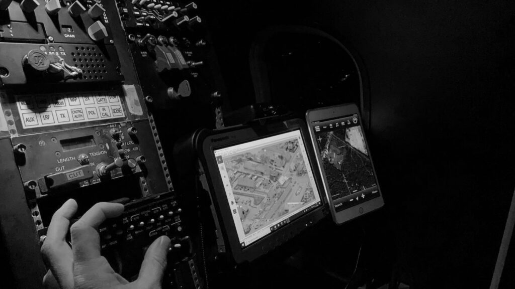
Operational Perspective: A CONOPS Guide and Checklist for Aerial Firefighting ISR and C4
The checklist below covers the key aspects of a CONOPS for framing and guiding the development and deployment of an airborne ISR and C4 system for aerial firefighting. Treat it as an aide-memoire: adjust, amend, or omit headings based on whether the information is known or available, and on the degree of operational or system sophistication involved.
When we arrive on a fire, one of the things we can do with the combination of AIMS and the sensor is see what’s in front of the fire. The fire generally moves with the wind, which means the smoke is often blowing ahead of it. From the cockpit, the ATGS can’t always see what’s there with the naked eye, but I can see through the smoke. One of my standing priorities is scanning those areas and identifying values at risk. If I find them, whether it’s a structure or something else, I can use AIMS to drop a point onto the common operating picture.
Shawn Scott, Director of Technology, Bridger Aerospace
1. Operational Context
Operational Environment
Describe the operating context for aerial firefighting missions: the type of platform, the typical mission, and the broad environmental factors that influence performance — terrain, smoke, weather, lightning-driven new starts, and communications constraints.
Mission Requirements and Scenarios
Outline how the system contributes to firefighting objectives: detecting and confirming new starts, updating perimeters, supporting the ATGS/IC during aerial suppression, identifying values at risk, and helping influence tactical decisions — adjusting containment strategies when conditions change, for instance. Draft brief use cases to show how the system improves situational awareness, planning, and coordination across both strategic and tactical missions.
Stakeholders and User Needs
Identify the core stakeholders involved in aerial firefighting operations — incident command, ATGS/air attack, ground crews, dispatch and coordination centres, GIS teams, and aviation operators — and summarize their primary needs around situational awareness, speed of information, safety, usability, and interoperability with existing ICS workflows and tools.
Operational Constraints
Outline the constraints that may shape system use, including regulatory and ICS coordination requirements, communications and bandwidth limitations, environmental conditions, and interoperability boundaries with existing fire-service tools and processes.
2. System Overview
Mission Software and Sensor Fusion
Describe how the mission software integrates with the aircraft’s onboard sensors (IR and EO/TV, for example) to provide geo-referenced situational awareness during both strategic and tactical missions. Emphasize how sensor video gains operational value when paired with maps, layers, and values-at-risk information, enabling faster, clearer decision-making for the ATGS, IC, and crew.
Communications and Information Sharing
Explain how the system communicates with the incident command structure and ground personnel, including radio coordination and data pathways for sending imagery, perimeter updates, or mission products. Highlight how shared situational awareness tools — COP applications, tactical snapshots, perimeter exports — reduce reliance on voice-only coordination and support planning, safety, and operational tempo.
Mission Products and Outputs
Outline the primary outputs the system produces during and after missions — new start detections, updated perimeters, IR imagery, tactical snapshots, or COP-ready data — and how these products support command decision-making, resource allocation, and operational planning.
3. Operational Concept
Operational Roles and Responsibilities
Identify who participates in the mission and who makes what decisions: the ATGS (airborne tactical coordination), the IC (ground strategy), aircrew and sensor operator (collection and contextualization), dispatch (tasking), and the consumers who use outputs for planning or review.
Operational Workflow and Procedures
Describe the mission flow at a high level, with focus on:
- Planning — tasking and objectives set
- Execution — air–ground coordination and decision-making
- Dissemination and review — how mission outcomes are shared and retained
Sensor Employment and Tasking
Describe how sensors are used differently across strategic (detection) versus tactical (air attack) missions, including tasking priorities such as values-at-risk identification, perimeter confirmation, spot detection, or observational RFIs from the IC or ATGS. Capture how modes or views are selected to adapt to conditions — altitude, smoke, cloud ceilings — and how tasking may shift dynamically based on fire behaviour or evolving suppression strategies.
Intelligence Collection and Reporting
Outline how collected data is transformed into intelligence products that support decision-making during and after incidents. Specify what products matter, who consumes them, and how they are disseminated across agencies. Consider the need for historical storage and retrieval for operational reviews, cross-border coordination, and expanding situational awareness over time.
4. Command, Control, Communication and Computers (C4)
C4 Structure and Decision-Making
Capture how tactical decision-making flows through the ATGS and IC, with RFIs directing real-time tasking. Note how mission software and sensors provide shared situational awareness to support faster, clearer decisions.
Communications and Information Flow
Describe how voice radios (ICS) and data pathways — streaming, snapshots, FTP exports — move information between air and ground.
Coordination with Ground and Joint Operations
Set out how the aircraft coordinates with ground resources and with partner agencies operating in the same airspace or incident, including how positions, annotations, and mission products are shared across organizational boundaries.
If I know where my resources are already versus not knowing where they are, I’m going to make more effective decisions.
Shawn Scott, Director of Technology, Bridger Aerospace
5. System Capabilities
Airborne Sensor Capabilities
Identify the use of MWIR, SWIR, and EO/TV sensors for heat detection, smoke penetration, flame and edge clarity, and visual identification, employed via a gimbal for tactical situational awareness.
Data Collection and Processing
Describe how sensor data is geo-referenced and shared in real time (snapshots, streaming, perimeter exports) and retained for post-mission review and planning.
6. Training and Human Factors
Operator Workflow and Situational Awareness
Consider how operators interact with sensor video and mission software during tactical air attack, including display layouts that balance video with geographic context, workload management under high tempo (radios, RFIs and mapping at once), and clarity of cues for values-at-risk or spotting. Ensure interfaces support rapid interpretation rather than detailed analysis.
7. System Development Plan
Deployment, Milestones and Deliverables
Outline the tactical plan for system deployment, including phased or full-scale deployment, sequences, milestones, and key deliverables. Explain the deployment schedule, including any dependencies and risks, and highlight critical dates.
Integration in Action: Operational Scenarios and Real-World Use Cases
The AIMS-ISR – ARTEMIS integrated system is driven by real scenarios, real challenges, and real necessities. The three that follow step into the cockpit to show how these capabilities support live operations.
Scenario 1: Navigating Safe-to-Drop Decisions in Low Visibility
A late-afternoon wildfire has advanced deep into a valley, and the fog is so dense that the crew has lost sight of the ground. They can no longer confidently drop the water they just collected. With critical visibility gone, the crew needs a way to understand where the ground team is and whether any civilians are in the area before they can safely conduct the drop. With winds increasing, the fire could advance hundreds of feet in just a few minutes, placing more homes at risk if the crew cannot act.
With ARTEMIS online, the operator turns to AIMS-ISR. As the aircraft moves towards the target area, the operator sets a geofence around the potential drop zone — and within seconds, three orange detections appear on the eastern edge of it, each one tagged as a first-responder device. AIMS-ISR converts the detections into tracks, revealing that the responders are moving west along the fire line. The operator immediately calls off the drop and designates a secondary zone farther west. A new geofence is drawn. This time, no ARTEMIS detections appear. The area is clear, and the team moves forward with the drop.
Without the integrated system, the aircrew would not have been able to complete the drop at all. Mobile-phone detection revealed the exact position and movement of the responders below, letting the crew avoid a dangerous drop and adjust their plan safely — the mission stayed on track, the responders remained safe, and the aircraft made an informed, timely drop rather than abandoning the run entirely.
Scenario 2: Restoring Communication in a Nighttime Evacuation
A fast-moving nighttime grassfire has knocked out the local cellular network, leaving residents of a small town and the first responders working it without a reliable way to communicate. From the aircraft, IR sensors show clusters of heat signatures spread across several miles. The crew knows people are out there but has no way to reach them, and ground teams are already stretched thin going door-to-door.
In the air, the operator brings ARTEMIS online to act as a temporary airborne base station and restore contact with nearby mobile phones. A mass alert goes out to the affected area with evacuation instructions and a confirmation route. Soon after, the AIMS-ISR display begins to show activity: vehicles start moving on the roads, and the EO/IR and GMTI sensors confirm steady outbound traffic as residents receive the message and leave the danger zone.
While monitoring the interface, the operator notices two black dots — unknown mobile phones — that remain stationary as the rest of the area clears. Using AIMS-C4, the operator pushes the locations and a short annotation to the ground teams’ ATAK devices. The updated icons appear on their mobile maps with the operator’s note: “Two unknowns, no movement. Possible assistance needed.” The first responders arrive and find a resident in a wheelchair and a caregiver struggling to deploy the ramp on their accessible van. The team helps load the resident safely, and the pair evacuates before the fire closes in.
Back in the aircraft, the operator watches the final black dots move away from the hazard zone. With every detected device accounted for and ground teams clear, aerial operations can safely resume.
Scenario 3: Using AIMS-ISR Advanced Features for Fast Action
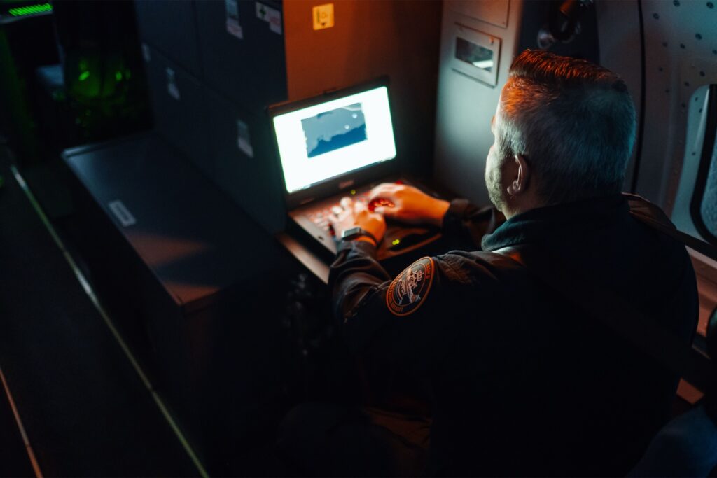
A large wildfire has drawn in multiple agencies. Fixed-wing tankers, UAVs, and ground crews are working the same area, and the RF environment is crowded. Onboard, the operator’s screen is cluttered with overlapping signals from every sensor. To stay focused, the operator declutters the display, silencing stale detections and setting alerts for any device that enters the danger zone defined by a geofence.
Mid-mission, a call comes in that a group of hikers may be somewhere ahead of the fire line, but ground teams have not been able to locate them. While the operator is focused on clearing a drop zone, an alert flashes across the AIMS-ISR interface: a mobile device has moved into the geofence. Because sensor slaving is enabled, the EO/IR camera pivots automatically to the location, revealing three hikers walking along a road.
Using ARTEMIS’ communication capability, the crew sends an emergency SMS to the hikers’ phones. Moments later, the operator watches their tracks turn around and move back toward safety, where first responders intercept them and guide them out before conditions worsen.
Without the integrated system, detecting the hikers would have taken far longer — and contacting them would have been impossible with cell networks down. The combination of decluttering tools, automated slaving, and mobile-phone detection prevented a situation that would have put not only the hikers’ lives at risk, but the first responders’ as well.
Beyond Aerial Firefighting: Multi-Mission Applicability
Whether the mission calls for a helicopter, a fixed-wing aircraft, or a UAV, the ARTEMIS – AIMS-ISR integrated system adapts to the platform and the situation. Crews can carry the same capability into a wide array of mission operations.
Search and Rescue (SAR)
In a SAR mission, the most critical question is often the simplest: where is the person?
With mobile detection aboard search and rescue aircraft, teams no longer have to search blindly. They can pinpoint an individual’s location, watch their movement, and position themselves where the rescue can be made safely — especially useful if the individual is unable to reach their device to communicate with the rescue team. If they can use their device, they can provide teams with critical information about their immediate situation, even in remote locations where standard cellular networks are unavailable. Over time, this level of accuracy has the potential to save thousands of lives.
Floods, Tsunamis, Hurricanes and Earthquakes
As floodwaters rise, power often fails and cell towers go dark, leaving first responders unable to reach survivors by phone.
Combined with AIMS-ISR’s mapping, alerts, and track display, the system gives responders a real-time picture of where people are, how they are moving, and who needs to be reached first. That view is critical during floods, when shifting water quickly displaces people, and during earthquakes, when locating trapped survivors quickly can mean the difference between rescue and loss.
Maritime Patrol
In maritime missions, visual detection alone often is not enough to find individuals in fast-moving, low-contrast environments.
Even in daylight, high swells can hide someone from view; at night, visual detection becomes harder still. In man-overboard or mass-rescue scenarios, ARTEMIS gives crews a new advantage: the ability to detect mobile devices even when the person carrying them is invisible to the eye or the camera. As the water carries individuals away from the initial incident, AIMS-ISR converts these detections into moving tracks, helping crews predict drift, prioritize survivors, and coordinate with vessels and rescue swimmers.
Post-Mission Simulation and Improvement
When operations are less than perfect, collecting and analyzing mission data offers a valuable opportunity for improvement. Crews can use data from the AIMS-ISR – ARTEMIS integrated system to reconstruct missions in a simulator, providing insight into where things went wrong. This post-mission understanding helps teams evaluate decision pathways and pinpoint areas that need adjustment to improve tactics, techniques, and procedures (TTP) for future missions.
The AIMS-ISR – ARTEMIS simulation capabilities enable
- After-action review
- Identifying operational gaps
- Operator training
- Crew coordination improvements
- Refining TTPs (tactics, techniques, procedures)
Tactics
When crews replay a mission, they can reflect on and study how their decisions unfolded in real time. The simulation shows exactly where confirmation delays happened, where safe-to-drop checks were slower than necessary, and how search patterns could have been adjusted once mobile detections appeared. Firefighters can reshape their tactical priorities so the next mission is faster, safer, and more deliberate. With every replay, crews learn how to use the integrated system to shorten the critical path to action and increase confidence in their decisions.
Techniques
Simulation also gives operators an opportunity to refine how they use the tools within the integrated system. They can adjust geofences to better match terrain, tune decluttering so the display shows only what is relevant in the moment, and fine-tune alert settings. These are the small technical adjustments that are hard to perfect in the heat of a wildfire when time is limited. A controlled environment lets operators experiment, fail safely, and develop stronger workflows for high-stress missions.
Procedures
Integrating a new capability into aerial firefighting requires more than learning features; it requires reshaping an entire crew’s workflow. Simulations help teams test how well their procedures apply the integrated system. They can study whether communication flowed smoothly once ARTEMIS enabled airborne messaging, whether confirmation routines were efficient, and whether coordination between air and ground was as seamless as possible. When something falters, mission simulation offers a clear view of why, giving leaders the information they need to update procedures and improve coordination across the entire crew.
Conclusion
Implications for Modern Aerial Firefighting Response
ARTEMIS mobile phone detection is an emerging capability in aerial wildfire response with clear value. Paired with CarteNav’s AIMS-ISR mission software, it becomes more than a stand-alone sensor: it becomes part of a coordinated system that strengthens decision-making, accelerates critical actions, and expands what aircrews can do in the moments when conditions complicate traditional firefighting methods. Safe-to-drop confirmations can be faster than ever, rescue missions become more targeted, and crews can move with a new level of confidence.
The same strengths that improve wildfire operations also translate across other emergency scenarios — from floods and earthquakes to maritime rescue and search-and-rescue missions — making the integrated mobile phone detection system a valuable asset for multi-mission emergency response.
At a broader level, this integration illustrates an important shift in aerial firefighting operations. As fires become more frequent and more difficult to fight, missions can benefit from new sensor capabilities — particularly when those capabilities are thoughtfully integrated into existing platforms. When designed and applied with operational realities at the forefront, next-generation technologies such as ARTEMIS can fill existing gaps and improve safety, coordination, and response effectiveness.
Explore how AIMS-ISR supports aerial firefighting and other multi-mission operations at cartenav.com/aims-isr, or browse CarteNav’s featured sensor and platform integrations.
Download the printable guide
Get the full designed PDF for printing, briefing and sharing with your crew.