“With the sensors working with each other and the AIMS-ISR data and radar plot overlaid on the same display, it’s far more user-friendly… There’s a lot less pressure on the operator.”
Theo Wilms, Dash 8 Sensor Operator, DCCG
Download Printable PDF
Download the PDF version for printing and sharing.
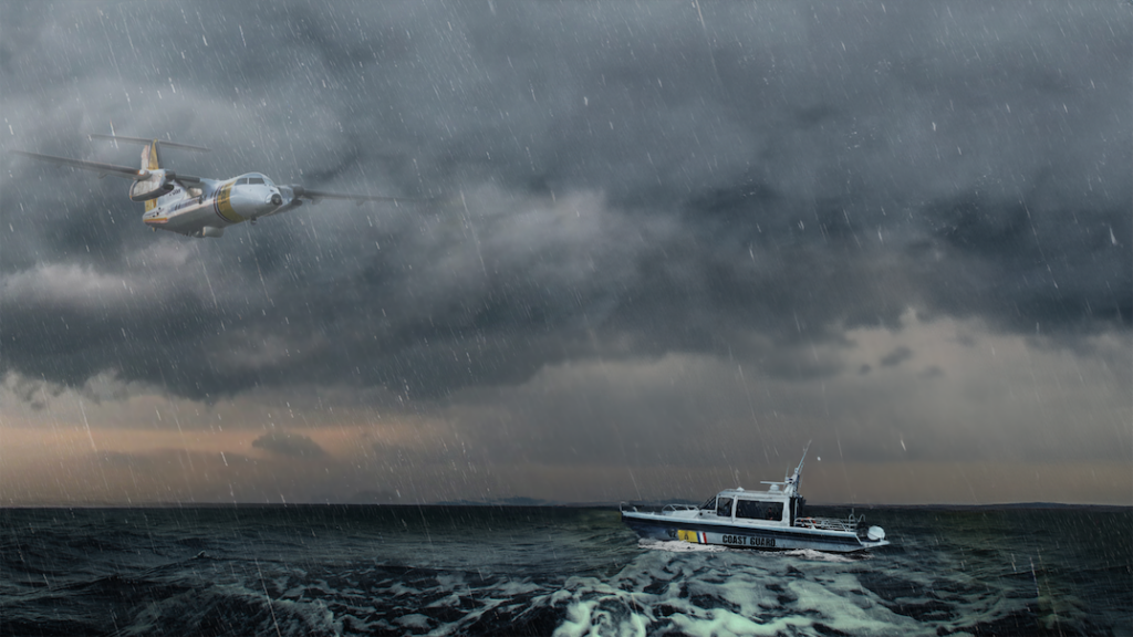
On a moonless night, two thousand feet above the southern Caribbean Sea, a De Havilland Canada DHC-8-106 (Dash 8) turboprop aircraft of the Dutch Caribbean Coast Guard (DCCG) is flying northwest toward the island of Aruba. It is returning to an area it had patrolled an hour earlier.
On his 23-inch display monitor, the Dash 8’s sensor operator, Theo Wilms, looks at the area scan feed from the aircraft’s IAI Elta radar. The scan shows numerous returns from ships on the sea below.
Updating the Recognized Maritime Picture
Overlaid on the radar feed, the aircraft’s AIMS-ISR mission management system has superimposed numerous symbols indicating the types and estimated locations of the craft Wilms had identified during the aircraft’s earlier pass over the area based on their previous course and speed. Many of these symbols lie close to the radar returns Wilms now sees on his screen. Others are farther away. Now, Wilms’s task is to update the recognized maritime picture (RMP) he had plotted during the earlier pass. He’ll do so by correlating the new radar tracks on his display with the vessels he had classified previously.
Wilms clicks on one of the tracks and commands an ISAR (inverse synthetic aperture radar) scan of its position. His display’s image changes to a grayscale image of a container ship. He sees that this is the same cargo vessel he identified an hour earlier, 20 nautical miles to the southwest.
Returning to his RMP display, Wilms can see that the vessel has turned slightly to the north from its previous route, leaving its dead-reckoning-calculated position shadowing it to the southeast. Using his cursor, he clicks and drags its previous track to its new location and commands an update. The system immediately correlates the symbology to the radar track to the vessel’s new course and speed. Wilms repeats this process for several other vessels, rapidly updating his RMP.
Investigating a Suspicious Vessel
Then, he sees it: a small circle indicating a radar paint, just a few miles west of Aruba, with no other symbols nearby.
Wilms selects the track and commands an ISAR scan. The ISAR shows a small, low-profile speedboat lying dead in the water—no wake behind it. The image reminds Wilms of a similar craft he had identified many nautical miles to the southwest during his Dash 8’s earlier pass over the area.
Wilms switches back to his moving map display, returning the radar to its area scan mode. He checks the position where he had identified the earlier low-profile. Since that vessel had also been at a dead stop when identified, the display still shows the data he had recorded for that vessel at the same position. Now, however, there is no radar track anywhere in the vicinity.
Meanwhile, as Wilms has been studying his RMP, a small white cross has moved across his display and has come to rest on the selected radar track. The cross indicates the boresight of the Dash 8’s Teledyne Star SAFIRE EO/IR imaging system. AIMS-ISR has automatically slewed the system’s turret-mounted camera to the selected target.
We promised them something fresh and new, and CarteNav delivered that with AIMS-ISR
Baron Smith, Director of Caribbean Operations, PAL Aerospace
With the press of a button, Wilms switches his display to FLIR (forward-looking infrared) to get a more detailed picture of the vessel. Wilms now sees a clear IR image of the ship and its crew. He feels certain this is the same low-profile he observed earlier. The two crew members— one slender, the other stocky and shorter, just as he remembered—appear to be pulling a tarp over their cargo of approximately a dozen water-proof plastic barrels in the back of the speedboat.
There is only one likely explanation for such a vessel to be out in these waters carrying cargo at this hour: drug running. Through AIMS-ISR’s integration with the Dash 8’s VHF/UHF radio, Wilms passes the suspect vessel’s coordinates to the DCCG Operations Center in Curaçao to initiate an intercept.
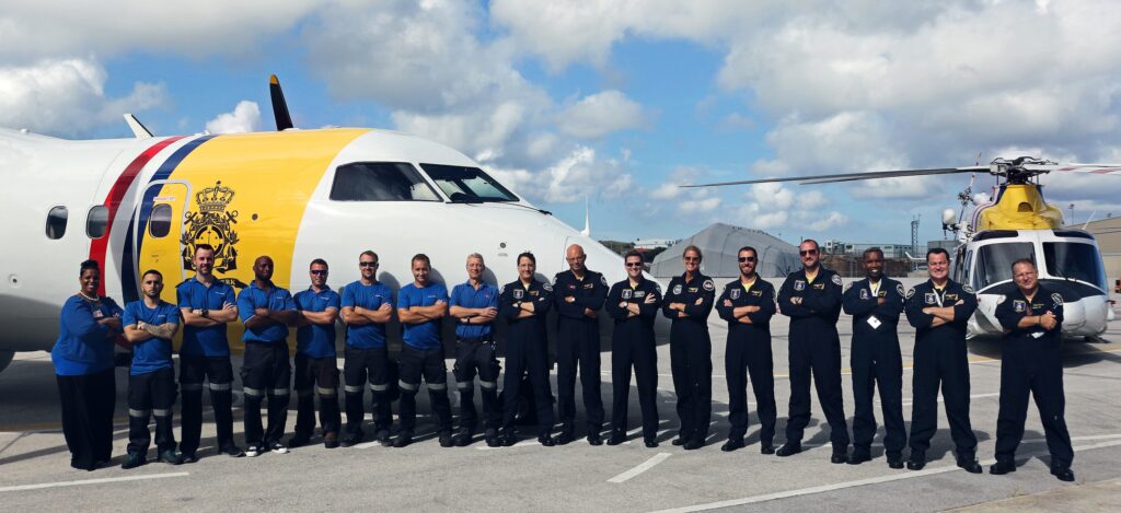
Patrolling the Dutch Caribbean
The Dutch Caribbean Coast Guard (DCCG) is a partnership between the Netherlands and the Caribbean
island nations of Aruba, Sint Maarten, and Curaçao. It provides coast guard services for the six islands of the former Netherlands Antilles. Besides the three autonomous constituent countries just mentioned, these include the three Netherlands special municipalities of Bonaire, Sint Eustatius, and Saba.
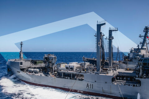
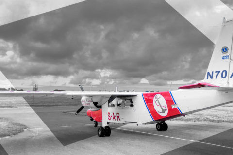
The duties of the DCCG include narcotics and arms interdiction, border control, customs control at sea, fisheries and environmental surveillance, monitoring of safe shipping, search and rescue, and disaster relief.
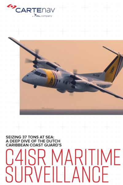
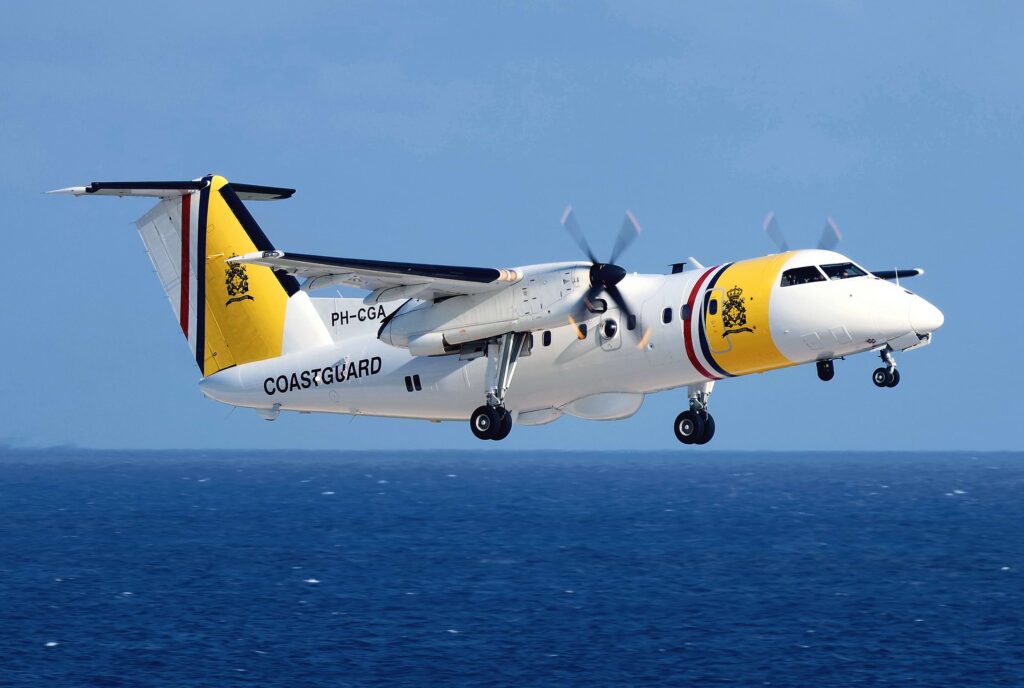
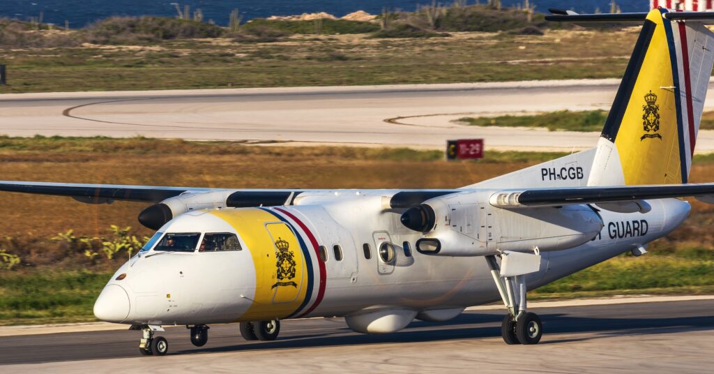
Since 2007, the DCCG has operated two Dash 8 aircraft for maritime surveillance. These are supplied under a contract to PAL Aerospace, a Canadian company headquartered in St. John’s, Newfoundland. Under their contract, PAL modified the aircraft to DCCG specifications and also supplied aircrew, maintenance support, and training.
Combatting Trafficking in Drugs and Arms
The crews of the two DCCG aircraft are tasked with monitoring the many vessels sailing the waters of the
Netherlands Caribbean—for the safety of the sailors aboard those vessels and that of the islands and their citizens.
Trafficking of narcotics and arms from South America is a big problem for the countries of the Dutch Caribbean. Much of this smuggling is done with small speedboats that are difficult to detect and monitor. Drug and arms runners have learned to cut their engines and stop when they hear a low-altitude aircraft approaching. The absence of a wake makes their boats more difficult to detect.
According to Theo Wilms, the key to maintaining this surveillance is to build up and maintain a cohesive,
coherent, recognized maritime picture covering the expanse of ocean the DCCG patrols.
“The way we operate is we patrol over an area for a certain time,” says Wilms. “Our ELTA radar detects contacts on the surface, and we see those on our display. We ISAR those contacts. We identify them; we classify them; we photograph them. Then we move to another area. Later, we
come back.”
“When we come back, our track files are no longer in realtime. The mission management system has maintained them through dead reckoning based on their last known location and speed. We need to re-associate the data we had stored on those vessels during our last pass over the area with the real-time locations the radar is now showing us on the display.”
A Hectic, Labor-Intensive Operation
For Wilms and his fellow sensor operators, maintaining the RMP had been a tiresome task.
There had been no sensor integration in the Dash 8s’ original configuration. Video feeds had to be viewed separately. Operators had to switch between the feeds on their monitors. The mission management system, PAL’s in-house-developed ADAM system, could not overlay its moving map on the radar and FLIR feeds, so operators had to correlate landmarks and political boundaries in their heads. All of this made building the RMP an extremely hectic and laborious task.
“With ADAM, we had a single display screen, and we had to switch between the two display feeds,” Wilms explained. “We had the feed from the ELTA radar and the feed from ADAM. We used the ELTA plot to initiate contact and identify vessels. Then, we had our classification symbology in Adam. We were constantly switching between the feeds and reorienting ourselves to the new display. We had to classify the contacts on both displays so that we could correlate them. It was double work. It cost us a lot of effort to line up our RMP.”
The lack of sensor integration also made it difficult to bring their FLIR to bear on small targets to identify possible contraband traffickers. Slewing the FLIR was performed
manually.
In addition, the original cockpit configuration created challenges for the crew. The SO station and that of the Tactical Coordinator (TACCO) had different functionality. The two operators were seeing different information. This necessitated frequent dialogue between them, increasing
their workload.
A Mission Management Solution From a Trusted Source
When the DCCG exercised the two-year extension option on their original ten-year contract, PAL and their contracting agency, the Dutch Ministry of Defense (MOD), agreed to upgrade their two Dash 8 aircraft.
PAL needed to replace the radar’s legacy analog processor with a digital processor to achieve proper sensor integration. Consequently, ADAM also had to be replaced. The latter was incompatible with a digital radar processor, and PAL no longer supported the ADAM software.
In addition, PAL wanted to upgrade the aircraft’s cockpit ergonomics to improve mission effectiveness and reduce crew workload.
For their new mission management software, PAL chose AIMS-ISR from CarteNav Solutions. This was a natural choice, as PAL Aerospace had acquired CarteNav as a wholly-owned subsidiary in 2016. From the moment of that merger, PAL had intended to make AIMS-ISR its successor to ADAM.
Download Printable PDF
Download the PDF version for printing and sharing.
AIMS-ISR provides multi-role integration, geo-referenced moving maps, evidence reporting, custom mapping, and more. It also offered plug-and-play compatibility with the radar processor that was to be integrated during the upgrade and with new sensors that would be added later.
Upgrading the Dash 8 Cockpit
PAL Aerospace led the integration effort with CarteNav, providing customization of the AIMS-ISR software.
Replacement of the ADAM software with AIMS-ISR permitted integration of the mission management computer with the radar and the FLIR turret. This, in turn, permitted the overlay of the AIMS-ISR moving map data on the radar feed and FLIR image.
Along with the AIMS-ISR and sensor integration, PAL homogenized the aircraft’s sensor monitoring stations. Functionality at the SO and TACCO stations is now practically identical. If necessary, either operator can now sit at the station of the other and do their job just as well.
The upgrade was scheduled to begin in November 2020, once the bulk of the hurricane season had passed. Apart from the technical difficulties of the task, PAL and CarteNav faced two major challenges during the upgrade program. The first was keeping the retrofit and acceptance program on its tight schedule. The second was maintaining operational readiness in the Caribbean with only one aircraft while the other was being retrofitted in Canada.
PAL had a backup plan to mitigate the risk posed by their reliance on a single aircraft. In case of a hurricane or problems with the in-service aircraft, an additional Dash 8 aircraft could be immediately dispatched from Canada to assist.
According to Baron Smith, Director of Caribbean Operations for PAL Aerospace and one of their Dash 8 pilots, meeting the delivery schedule for the upgrade program was “a bit stressful.” While having an additional Dash 8 standing by in Canada provided some comfort, the overall magnitude of the task created anxiety.
“AIMS-ISR did need substantial customization to work for the DCCG, but between the PAL group and CarteNav, we worked really closely together to make sure the product we were delivering was a good one. We didn’t want to roll it out the door until we were absolutely sure it was good to go.”
COVID-19 also had a big impact on the schedule. “With people working from home, everything connected with the acceptance test program at Curaçao was harder and slower,” said Smith. “We had significant supply-chain issues, so some delays were expected.”
Maintaining Operational Readiness
Having only one aircraft available in Curaçao put a lot of pressure on PAL and the DCCG.
“With one aircraft in Canada, we were always pretty nervous,” said Smith. “We always have to have at least one mission-capable aircraft.” Nevertheless, PAL and the DCCG proved up to the test. They worked closely together to ensure mission reliability and on-time dispatch reliability while flying more than they ever had before— some 2,650 hours with a single aircraft.
Despite the unrelenting mission tempo, operational readiness remained high. “Actually, it was probably our best,” said Smith. “We were 99.8% on mission reliability and 99.7% on dispatch reliability, which is amazing considering we were flying 250 hours above our contract requirement. Overall, there was zero impact on operations. That was what was really impressive.”
It doesn’t make you so tired over eight hours flying, because AIMS-ISR is helping you.
Theo Wilms, Dash 8 Sensor Operator, DCCG
That’s a big advantage for the operator.
Greatly Improved Situational Awareness
With PAL’s original ADAM system, operators had to switch between moving maps, radar, and FLIR on their main display because each fed the monitor through a separate input. Now, with the radar and FLIR fed through AIMSISR, operators see the radar or FLIR image overlaid with geographical features, geopolitical boundaries, waypoints, and other moving map references that can help them interpret the sensor image.
For example, both operators now see overlays of geopolitical boundaries. That means either operator can help the pilot steer clear of other countries’ territorial waters, allowing the pilot to focus primarily on flight safety. Everyone in the cabin is better aware of where they are and of the situation in the air and in the water.
“Before, it was almost up to the TACCO to keep us out of those areas,” said MacLeod. “I can do that on the radar now because I have all those overlays on my radar display. It cuts down the workload for the TACCO, and I get the bigger picture.”
Also, AIMS-ISR’s modular display windows make the system more flexible. “With ADAM, everything was locked in place,” said MacLeod. “With AIMS-ISR, the operators can move windows around and customize how their information is laid out. It lets us adapt to different mission profiles.”
Reduced Operator Workload
With more information on their screens and simultaneous access to correlated images and data, the crew workload has been greatly reduced. MacLeod explained that with both the TACCO and SO seeing the same information, the need for discussion amongst the crew has been significantly reduced.
In a search and rescue (SAR) situation, for example, the display overlays make it much easier for the SO to direct the pilot to a survivor or to something that’s floating in the water. Plus, with all the information in front of him and the radios integrated into the AIMS-ISR system, the SO can handle all the sensor operations and monitoring by himself. This comes in handy when the TACCO must leave his station to attend to other SAR duties, like dropping rafts and other loads.
“With the sensors working with each other and the AIMSISR data and radar plot overlaid on the same display, it’s far more user-friendly,” said Theo Wilms. “It’s much easier to build up the RMP, so there’s a lot less pressure on the operator.
“With Adam, because of the high workload, we were always under a lot of time pressure to build up our RMP. We didn’t have a lot of time to communicate and evaluate the RMP.”
Wilms says the situational overview AIMS-ISR presents helps reduce operator stress and fatigue. “It doesn’t make you so tired over eight hours flying because AIMS-ISR is helping you. That’s a big advantage for the operator,” he said. “You can see, okay, that’s an AIS track, and there’s
the radar track; they belong together. Then, I can take a snapshot with the FLIR; it slews right to the selected track. The saved media associated with that track can be called up from the symbol on the track. Operations are quick, easy, and intuitive. It’s really progressive and a really good, workable software system. AIMS-ISR is really a step forward for us.”
Simplified Operator Training
Having everything the operator needs all on one screen at the same time makes training new operators much easier, said MacLeod. Operators find the new system more intuitive.
Another AIMS-ISR feature that helped in training was the AIMS-ISR Development Tool. The tool simulates aircraft movement and navigation on the screen. It gave PAL a ground-based dynamic environment they didn’t have before.
The Development Tool allows trainees to try things out on their own. It helps them find different and more efficient ways to accomplish tasks. MacLeod was surprised by how fast operators picked up the system operation. “AIMS-ISR is a game-changer for training,” he said. Theo Wilms concurs. “The training was really helpful,” he said. “And because it’s Windows, we were able to work with the real AIMS-ISR software in the classroom, right on the monitor. It’s really easy to understand how it works. It’s very intuitive.”
Greatly Improved Mission Effectiveness
The integration of AIMS-ISR with the new digital radar processor allows the system to filter radar contacts on the surface much more successfully and efficiently. DCCG’s SOs are seeing many more plots on their displays than they had before.
“AIMS-ISR is giving us radar plots right away,” said Wilms. “Each of those tiny round symbols is a trigger for the operator: Go to that contact and ISAR it. As a result, we find a lot more low-profile radar contacts and possible fast movers. With Adam, we would typically find two or three of those a month. Now, with AIMS-ISR, we find three or four low-profiles every week. We seized 37,000 kilos of drugs last year.”
Improved Customer Relationship
The performance of PAL and CarteNav during the bridge extension upgrade and the enhanced mission capabilities AIMS-ISR provided all had a significant positive impact on PAL’s relationship with the Dutch DMO.
“We promised them something fresh and new, and CarteNav delivered that with AIMS-ISR,” said Smith. “The DMO was very excited about the capabilities of AIMSISR—not just the way it is now, but the things we were talking about doing in the future under the new contract.”
Upcoming Improvements
That new contract—the follow-on ten-year contract to support the DCCG—was tendered by the Dutch DMO while the upgrade program was underway. PAL Aerospace won the contract bidding AIMS-ISR. The new pact will extend PAL’s partnership with DCCG until at least 2034. PAL will soon send the first aircraft back to Canada to start another round of upgrades, adding several new sensors.
“Another nice thing about AIMS-ISR is that it’s designed so that new sensors are plug-and-play,” said Baron Smith. “AIMS-ISR works with the Star SAFIRE III FLIR turret the aircraft has now, but it also supports the WESCAM MX-15 EO/IR gimbal that will replace it, as well as the ViDAR optical radar that we’re adding.”
About Dutch Caribbean Coast Guard
The Dutch Caribbean Coast Guard (DCCG) is a partnership between the Netherlands and the Caribbean island nations of Aruba, Sint Maarten, and CuraÇao. Since 2007 DCCG has been operating two De Havilland Dash 8-100 Maritime Surveillance Aircraft from the Coast Guard Air Station Hato at the CuraÇao International Airport. The Maritime Surveillance Aircraft’s primary operations include surveillance for means of preventing drugs and arms trafficking, border control, environmental surveillance, search and rescue, and hurricane response.
Download Printable PDF
Download the PDF version for printing and sharing.