“I’ve enjoyed the working relationship with CarteNav and found them very responsive to our needs. Together we’ve provided the Royal New Zealand Navy with a great product.”
– CDR Alan Parker, RNZN
When the Royal New Zealand Navy commissioned a new, state-of-art sustainment vessel, it turned to CarteNav Solutions for a commercial off-the-shelf (COTS) solution to its integrated sensor management requirement. Through seamless sensor integration, CarteNav’s AIMS-ISR provides a comprehensive local operating picture that optimizes the crew’s situational awareness and contributes significantly to its mission effectiveness.
Download Printable PDF
Download the PDF version for printing and sharing.
The Royal New Zealand Navy upgrades its logistics support fleet
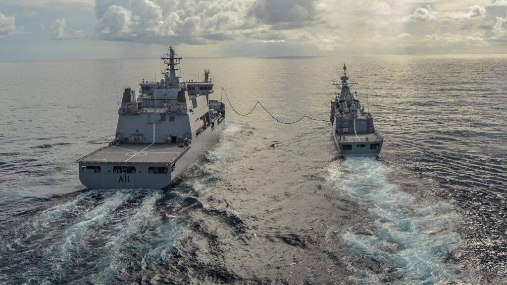
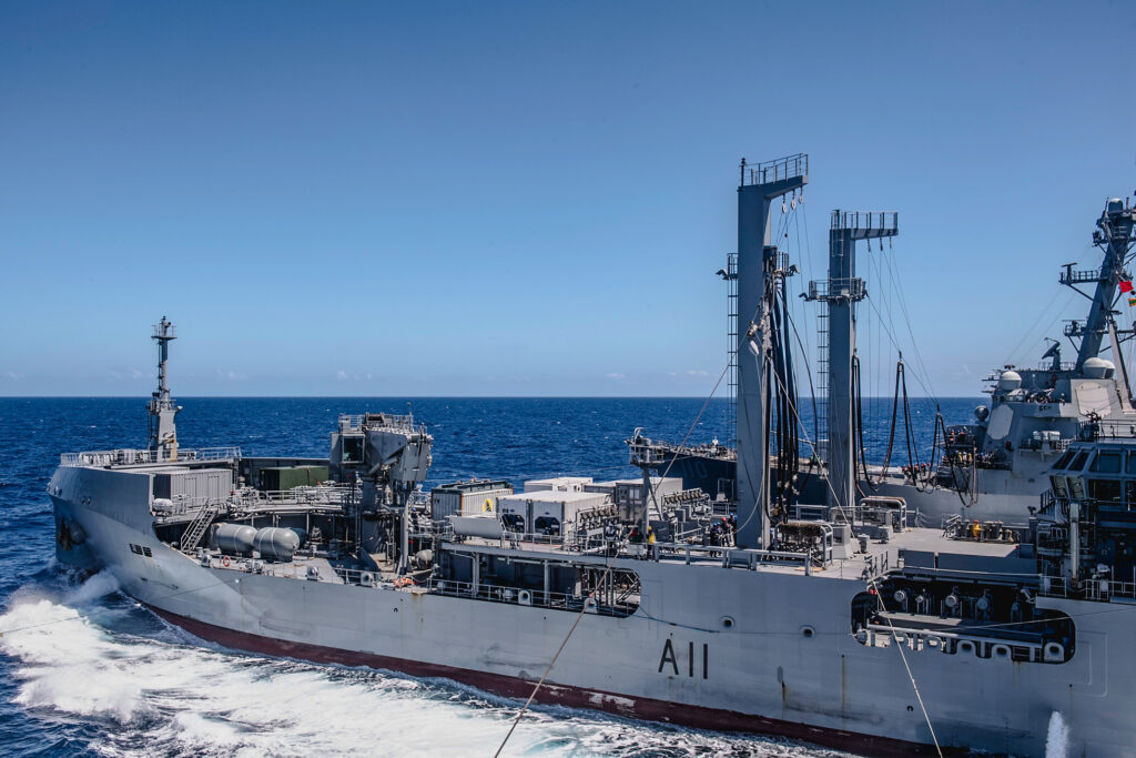
In July 2020, the Royal New Zealand Navy (RNZN) commissioned the latest addition to its fleet, the HMNZS Aotearoa. (Aotearoa is the Māori name for New Zealand, commonly translated as “the land of the long white cloud.”)
The Aotearoa is a Polar-class Maritime Sustainment Capability (MSC) vessel built by Hyundai Heavy Industries (HHI). Its primary mission is to provide global sustainment to New Zealand and coalition maritime, land and air units and to United Nations security operations through resupply of ship and aviation fuel, dry goods, water, parts and ammunition.
Aotearoa is built to polar class 6 certification (Summer/autumn operation in medium first-year ice) as its roles include Southern Ocean monitoring and Antarctic operations including the resupply of McMurdo Station and Scott Base.
Effective sensor integration was a key requirement
Due to the nature of the operations it conducts, Aotearoa can find itself in potentially hazardous situations.
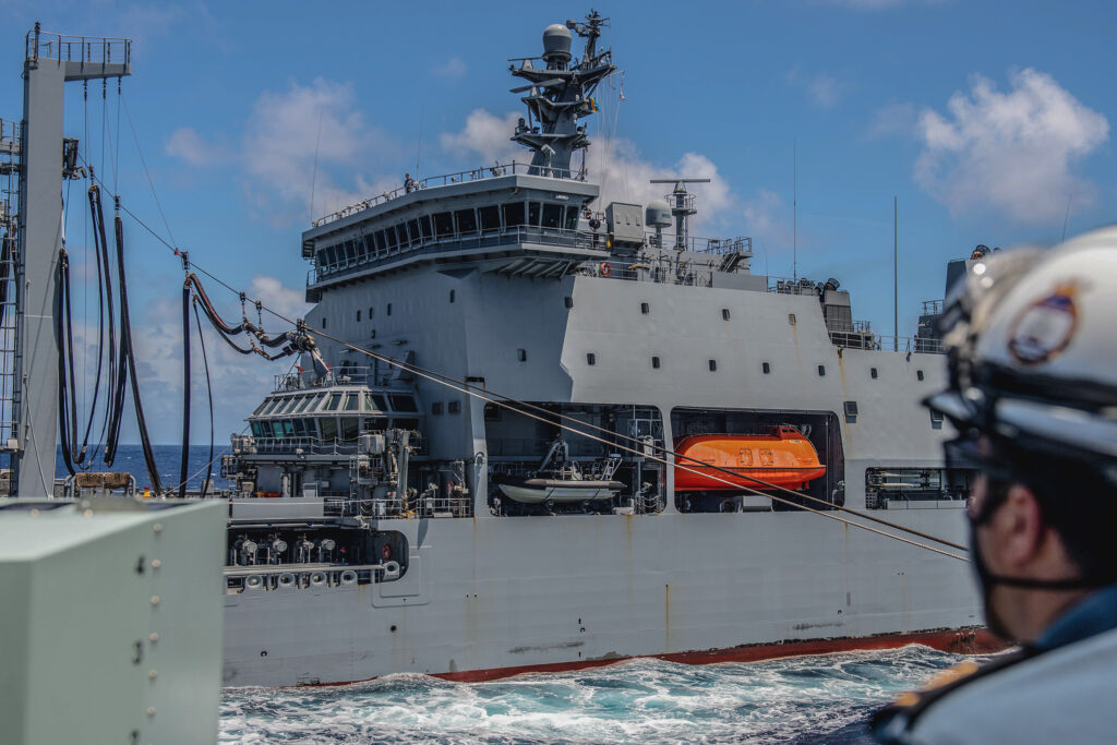
The ship’s refueling and resupply duties necessitate frequent close proximity to other ships. Close-to-coast operations, like Antarctic base supply and Humanitarian Assistance Disaster Relief (HADR) missions, can position it in dangerous waters—near icebergs, storms, and even active volcanos.
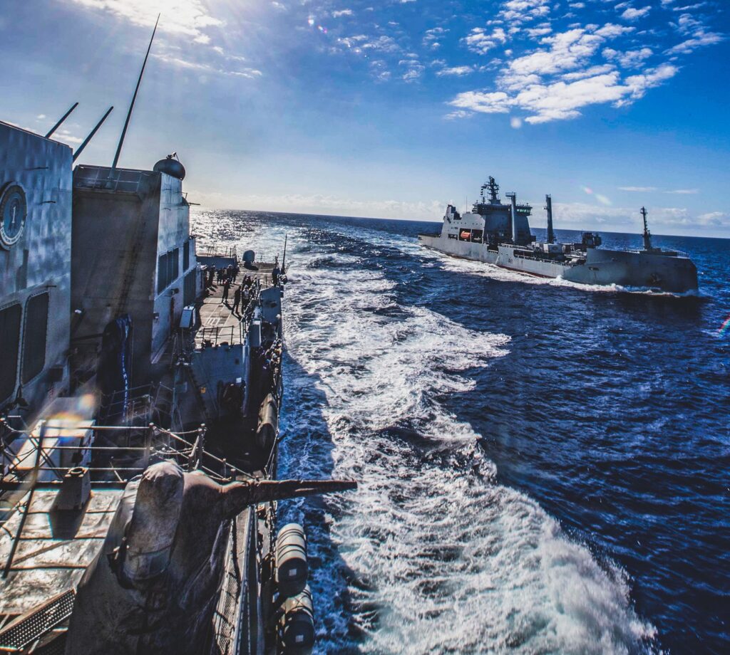
Aotearoa also takes part in joint task force operations. These multinational endeavors necessitate the coordination of movements with many other ships during re-supply operations and in the handing off of positions of unknown vessels and aircraft to other task force members.
In all these scenarios, the performance of a ship and its crew benefits from effective sensor integration. The ability to quickly and accurately bring multiple sensors to bear on a single target track—and having data from each of those sensors collated for each track on a single screen—clarifies the local operating picture and optimizes the crew’s situational awareness. “The cameras are quite important to their operation,” said Ian Horton, Senior Software Developer at CarteNav Solutions. “They rely on them heavily. If they’re maneuvering to supply another ship, they want to put a camera on it. If they’re running close to the coast, they want to put the cameras there to see what’s happening. The ability to quickly slew a camera to radar tracks that appear on the operating picture—to observe and identify other ships—is also crucial.”
“On Aotearoa’s predecessor, the bridge navigation system was the only integrated electronics on board. But with a mission system, you receive data from all the sensors around the ship and collate it in one place to create a comprehensive local operating picture. That’s the benefit of using AIMS-ISR in addition to a navigation system.”
– Jane Matthews, Senior Project Manager, CarteNav Solutions
For Aotearoa, the RNZN needed the advanced sensor integration and situational awareness capabilities of a modern military ship of the line but could not justify the cost of a bespoke military-grade integrated sensor management system (ISMS) like those on its combat frigates.
Still, Aotearoa needed some form of ISMS.
Enter AIMS-ISR — the “off-the-shelf” ISMS
An ISMS is a local area network (LAN) that provides connectivity between computers, sensors, and navigation systems aboard a ship. The data received over the ISMS can be viewed by the crew on the system’s display monitors, collated and processed via the user interface, and stored for later review.
In 2017, HHI selected CarteNav Solutions of Halifax, Nova Scotia, to provide the ISMS on board Aotearoa. CarteNav’s ISMS solution for Aotearoa included:
• AIMS-ISR v.10 mission management software
• Several host computers in a rack
• Three workstations
The AIMS- ISR software was developed by CarteNav Solutions, who would customize it to meet the RNZN’s requirements. The hardware would be developed by CarteNav’s New Zealand-based subcontractor, Marops, who would also supply the RNZN with in-country maintenance and support of both the hardware and software, along with training for the system operators. The workstations were deployed in the ship’s central bridge area, the operations room, and the classified ISR compartment.
As the centerpiece of the ISMS, AIMS-ISR would be integrated with the required sensors and systems aboard the ship and present a comprehensive local operating picture (LOP) to the crew. One of the factors that made AIMS-ISR attractive to the RNZN for Aotearoa was the fact that they already had more than a decade of experience with an earlier version of the product. AIMS-ISR v. 7 had been in use since 2008 on the
RNZN’s multi-role ship, offshore and inshore patrol vessels. Other important factors were cost and support. The RNZN already had a strong, ongoing relationship with Marops, and according to Commander Alan Parker, the RNZN’s Capability Integration Lead for the MSC program, the combination of a commercial off-the-shelf (COTS) solution combined with available local support in New Zealand weighed heavily in CarteNav’s favor.
A challenging integration program
HMNZS Aotearoa was specified with a huge sensor array, which made the ISMS integration task a formidable challenge. The vessel’s sensor suite includes:
• Hensoldt (Kelvin Hughes) Integrated Navigation Bridge System (INBS) with:
– SharpEye X-band/S-band doppler navigation radar
– Helicopter Approach Control Radar (HACR)
– NAVDDS (DGNSS and INS)
– Meteorological and Environment System
• Automatic Identification System (AIS)
• Automatic Dependent Surveillance–Broadcast (ADS-B)
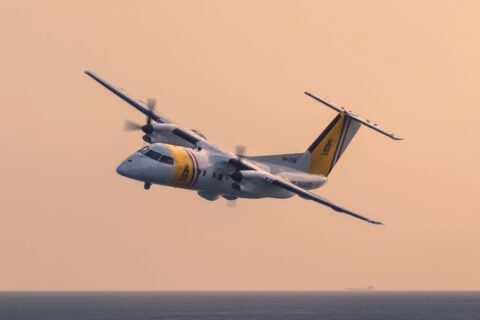
• Two Rafael Toplite EOS cameras, fore and aft
• Electronic support measures (ESM), including:
– Radar Detection System (RDS)
– CommSECA Communication Detection System (CDS)
• Over-the-horizon radar (OTH-GOLD), which exports to the Global Command and Control System (GCCS)
network
Each of these systems provides different kinds of information. AIMS-ISR had to be able to correlate this disparate data into the moving map display (MMD). Correctly integrating all these data streams required coordination among many suppliers, all of whom were making their own modifications while simultaneously reacting to changes made by others. Ensuring the frequent and rapid distribution of up-to-date interface control document (ICD) information was essential. This proved to be a significant challenge.
“It was quite a mix of sensors we were trying to integrate, and even though they all have their standard
interfaces, integrations of that type are never completely straightforward,” said CDR Parker. “Early on, there were a lot of things that—according to the ICDs— we should have been seeing, but we weren’t seeing. We had to reach back to the vendors to get some background on what was happening within their systems to figure out why some bits of data weren’t getting to the AIMS-ISR over the network. As is typical in these software-based installations, the integration was really the biggest challenge for us.”
Stabilizing the Ethernet backbone that enables communication between the various subsystems of the ISMS was another sticky wicket.
“During integration in Korea, we experienced some very complex networking issues,” said Herman Van de Ven, Director of Projects at CarteNav Solutions. “Luckily, by beating the bushes in Seoul, we were able to find a local subcontractor who got us over that hurdle.”
Download Printable PDF
Download the PDF version for printing and sharing.
And then along came COVID
While Aotearoa was still being fitted in Korea, COVID-19 began its sweep across the globe. The travel and contact restrictions imposed during the worst of the pandemic slowed the final phases of
integration and acceptance testing. When the ship finally docked in New Zealand, the country was under
heavy lockdown. Progress slowed to a crawl during the integration of classified systems, harbour acceptance trials, and sea acceptance trials.
“Not being able to travel to Korea while some of these installations and set-to-work were happening, we had to accept a lot more risk in accepting the ship,” said CDR Parker. “Then we had to bring the ship back to New Zealand and try to resolve those issues during the lockdown. Needless to say, COVID really affected our plans in a lot of ways – as it did for the rest of the world.”
Fortunately, thanks to their close relationship with the Navy, Marops was able to provide great in-country support and facilitate communication between the RNZN and CarteNav. This mitigated the difficulties and demonstrated the value of local support. In return, the RNZN was very accommodating and understanding.
Greatly enhanced situational awareness
Today, thanks to the seamless sensor operation and comprehensive local operating picture provided by AIMSISR— not to mention a host of new features in AIMS-ISR v. 10—HMNZS Aotearoa has capabilities far advanced from those of its predecessor.
The greatly enhanced situational awareness AIMS-ISR
provides helps the ship’s crew carry out their duties more safely and efficiently.
As an example, CDR Parker explained how an MSC vessel like Aotearoa carries out fleet replenishment during a military operation. The MSC is assigned a specific, rectangular route, called a “race track” that it sails up and down while supporting the fleet. “AIMS-ISR allows us to plug in the coordinates of that race track,” said Parker. “As the tanker’s doing its circuits and replenishing ships, the indications AIMS-ISR gives us on the moving map display help us make sure we’re sticking to the box we’ve been allocated.
“We can monitor tracks entering and exiting the box for coordinating with the frigates and destroyers coming in to be refueled. We’re also aware of any merchant ships that might come into the area, so we can preempt any incursions into the box that may disrupt the activity. All the while, AIMS-ISR is providing situational awareness well beyond the direct area of operations in which the tanker is doing its replenishment. It’s fusing all of those various sensors together into one picture to make sure we can conduct that activity safely. It’s really a key contributor.”
“The rich selection of track information being fed into AIMS-ISR gives operators a much more
– CDR Alan Parker, RNZN, Capability Integration Lead for the MSC program
comprehensive picture than what they can see out the bridge window. That’s the real-world advantage it brings to a tanker.”
Networked for better self-defence and modern warfare
AIMS-ISR’s comprehensive sensor integration helps Aotearoa’s crew deal more efficiently with radar detections of potential threats.
Since AIMS-ISR is integrated with the AIS and ASD-B, all the operator has to do is click on the target. If the target is a ship broadcasting its AIS data, that data will be presented to the operator. If it’s an aircraft broadcasting on ASD-B, the operator will see that data. If the target isn’t broadcasting on its transponder, the operator will see that as well.
In any case, the system can quickly slew one of the ship’s Toplite cameras to the location. The operator can then get a visual on the target, confirm whether it is a friend or a foe, and initiate defensive measures if warranted.
In addition, AIMS-ISR’s integration with the OTH-GOLD network allows Aotearoa to effectively participate in joint task force operations with other military commands. Through OTH-GOLD, Aotearoa can share AIMS-ISR’s unified track data with the entire task force over the GCCS joint command and control system.
Outstanding return on investment
While still new to the RNZN fleet, HMNZS Aotearoa has already proven itself highly capable and a great investment.
In just its first year of service she:
• Helped provide relief to the victims of the Tonga tsunami (Jan. 2022)
• Provided support for environmental and scientific missions in the Antarctic
• Participated in Exercise RIMPAC (Rim of the Pacific) 2022
The last of these missions, RIMPAC 2022, is the world’s largest international maritime exercise. Naval and marine forces from 26 countries participated. For Aotearoa, it was it’s first taste of major multinational task force operations. During the exercise, the ship conducted twenty replenishment at sea operations, delivering 6.48 million litres of diesel and 107,420 litres of aviation fuel to vessels
from France, Australia, Canada, Malaysia and the United States. With the help of AIMS-ISR, all those operations came off without a hitch. Needless to say, the RNZN is pleased with the results of the MSC program.
They have also been pleased with the performance of AIMS-ISR and ISMS on Aotearoa, as well as the support they’ve received from CarteNav Solutions and Marops.
About HMNZS Aotearoa
His Majesty’s New Zealand Ship (HMNZS) Aotearoa is an Auxiliary Oiler Replenishment (AOR) vessel and is the largest ship in the Royal New Zealand Navy’s fleet.
An IACS Polar-class 6 logistics support ship, HMNZS Aotearoa, is designed and built to support and resupply other vessels, helicopters and land-based units.
Commissioned into service on July 29, 2020, HMNZS Aotearoa conducted its first replenishment during sea trials on March 3, 2021.
Download Printable PDF
Download the PDF version for printing and sharing.