_____________________________________________
“Mission software that would unify all sensor data from various sensors we were using at the time, and would allow us to plan missions and also distribute ISR data, including metadata to our customers.”
Patrick de Jong
_______________________________________________
Download Printable PDF
Download the PDF version for printing and sharing.
When AEC Skyline Needed JTAC Training, It Turned to CarteNav.
For all the lethality and sophistication of modern precision-guided weapons, their effectiveness often depends on one person. Without a Joint Terminal Attack Controller (JTAC) to direct close air support from aircraft, helicopters, and even drones, even the most accurate smart bomb might miss its target – or hit friendly forces or even civilians. But an effective JTAC is a well-trained JTAC. Hence, NATO nations go to great lengths to give their JTACs the training they need. That’s why AEC Skyline, a Dutch defense aviation company, trains JTACs from several NATO forces, including the Dutch military and U.S. Air Force Europe(USAFE). In particular, AEC Skyline has been providing Digitally Aided Close Air Support (DACAS) training, in which controllers and strike aircraft exchange target-ing information via data links, rather than just voice radio as in World War II.
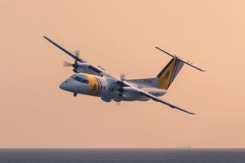
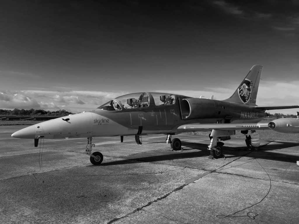
To accomplish this, the Dutch company maintains a fleet of aircraft and drones, including L-39 Albatros trainers and a single Learjet that are used for DACAS training as well as ISR and electronic warfare practice. The aircraft are equipped with L3/Harris WESCAM MX-10 and MX-15(D) turrets with electro-optical and infrared (EO/IR) sensors and laser spot tracker that locate targets and send targeting data to JTACs during exercises.
AIMS-ISR unifies DACAS data
DACAS is a vast improvement over old-fashioned voice communications for delivering close air support accurately and efficiently. But the technology presents its own challenges. Merely relaying targeting data isn’t enough: the data must be combined into a comprehensive and understandable operating picture to maximize situational awareness. Then there is the problem – familiar to the military and civilians alike – of incompatible systems, and devices not designed to work with each other. “We needed something specific when it came to mission system software,” said AEC Skyline’s operations manager Patrick de Jong. “Mission software that would unify all sensor data from various sensors we were using at the time and would allow us to plan missions and also distribute ISR data, including metadata to our customers.”
Then in 2010, AEC Skyline learned about AIMS-ISR, from Canadian manufacturer CarteNav. With over 500 installations for military and law enforcement customers in more than 40 countries, CarteNav’s AIMS-ISR integrates numerous types of sensors, including radar and electro-optical, communications intelligence (COMINT) and electronic support measures (ESM), ViDAR, moving target indicator (MTI), and maritime Automatic Identification Systems (AIS).
AIMS-ISR mission management software can be hosted by numerous devices, from aircraft mission computers to laptops and tablets. Its low size, weight, and power (SWaP) requirements allow installations on various platforms, including fixed- and rotary-wing aircraft, remotely piloted vehicles, aerostats, ground vehicles, and ships. These capabilities make the system suitable for a variety of missions, including ISR, maritime patrol, search and rescue, border security, disaster response, law enforcement, and infrastructure inspection. Various versions of AIMS-ISR are used by military and law enforcement agencies worldwide, including the UK, Canada, Australia, and Indonesia.
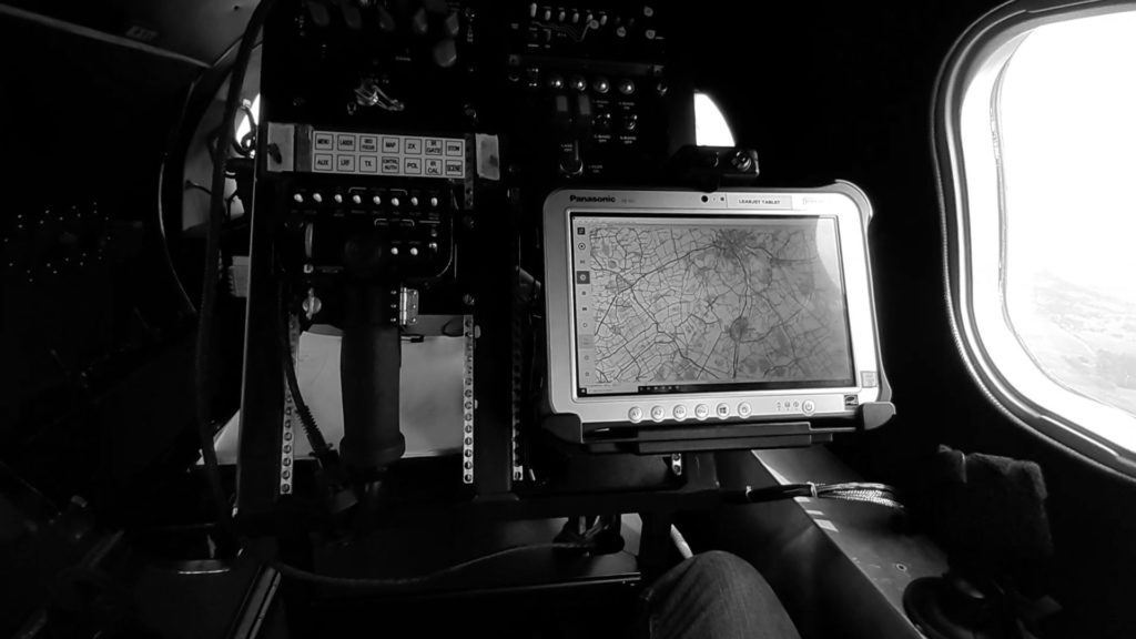
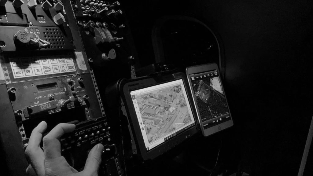
Data overload has become a recurring problem in ISR operations. AIMS-ISR tackles this issue by combining data from disparate sources into a real-time user interface that lets operators configure their displays for maximum focus on crucial points of interest. A typical screen display might feature a moving map and local operating picture, live video from an electro-optical camera, and augmented reality overlays marking the ISR’s aircraft position and camera footprint, as well as textual information on targets. Depending on user needs, other features include terrain-corrected sensor footprints, perimeter mapping, and customized and searchable databases. AIMS-ISR is designed to work seamlessly with sensors and other systems from the world’s leading manufacturers, including L3Harris, Thales, Flir, Leonardo, Telephonics, Hensoldt, Elbit, SAFRAN, and many others.
Download Printable PDF
Download the PDF version for printing and sharing.
Why AEC Skyline chose AIMS-ISR
“I remember we discovered CarteNav during a small scale exhibition in Brussels some 10 years ago,”
de Jong recalled. “That’s when we started to delve deeper into the technology being offered by the company.”
What ultimately induced AEC Skyline to select AIMS-ISR was ease of integration with different platforms and systems. “Because AIMS-ISR is platform-, sensor-, and hard-ware-agnostic, it allowed us to seamlessly connect with customers’ existing systems while delivering accurate, prompt and comprehensive information, all this in a user-friendly manner,” de Jong said. “The fact that it is ITAR-free [International Traffic in Arms Regulations] is another advantage.”
AEC Skyline now uses AIMS-ISR to train almost 100 JTACS — from multiple nations — every year. The company’s personnel quickly discovered that AIMS-IRS vastly improved the quality and convenience of training JTACS.
“During ISR missions, through its networking capability, AIMS-ISR allows us to remotely control an EO/IR sensor pod fitted on a surrogate UAS or on any other ae-rial platform from our ground control station,” said de Jong. “Meanwhile, the addition of AIMS-ISR has also allowed us to upload files from military flight planning software such as FalconView, making us instantly interoperable with customers from the Netherlands
Air Ground Operations School [NLD AGOS], for instance.”
“Meanwhile, the addition of AIMS-ISR has allowed us to upload files from military flight planning software such as FalconView, making us instantly interperable with customers from the Netherlands Air Ground Operations School (NLD AGOS), for instance”
– Patrick de Jong
AIMS-ISR enables interoperability
AIMS-ISR tackles the interoperability problem by seamlessly combining data from multiple sensors — that especially for legacy systems that were never designed to work with each other – into a single combined display.
It also enables operators to easily distribute data among a network or kill chain. “We developed a ground control station that steers the sensor pod, collects data and video, and sends AIS data to the aircraft or collects it from the aircraft,” said de Jong. “The Same goes for GMTI [Ground Moving Target Indicator]. Furthermore, using the Cursor on Target (CoT) messaging format, AIMS-ISR enables quick target handover.”
AIMS-ISR allowed AEC Skyline to take its business model to the next level. “Increasingly our expertise lies with systems integration, instead of just operating a fleet of ae-rial platforms,” said de Jong. “Over the years we have built up the right engineering skills together with a considerable network of industrial partners. This al-
lows us to select and integrate the right mission systems or a combination thereof, depending on the requirement at hand, regardless of whether this applies to a land, aerial or naval platform, as we cover all these domains. Typical mission systems include optronics, video encoding, datalinks, mission software. The latter systems are where CarteNav comes in.
Another selling point for AIMS-ISR is CarteNav’s customer support. When de Jong joined AEC Skyline and began working with AIMS-ISR, he needed help. “It was new for me when I joined, but my relationship with Scott
[the CarteNav technical representative] grew over time. We were testing things like GMTI and SAR [Synthetic Aperture Radar]. It was really easy to use AIMS-ISR because of the support that we got. Everything was working together. The system met all our requirements.”
CarteNav was also there when AEC Skyline encountered growing pains, such as some temporary difficulties integrating AIMS-ISR with the Windows operating system. “We had a lot of technical issues running the program on Windows,” de Jong said. “I would write Scott an email that said ‘okay, this is what’s happening. Why is it happening? We would like to do this and this. How can I do them?’ I would give him a lot of feedback, and he would help. For example, one of the things he taught me was to create a cache, so
I wouldn’t have to start all over again each time we used AIMS-ISR.”
Preparing for the future of CAS
What’s the next step for AEC Skyline and AIMS-ISR? Most recently, the company has been working on a cutting-edge concept: manned-unmanned teaming (MUMT), in which manned aircraft and helicopters operate in conjunction with drones and JTACs. In 2021, AEC Skyline’s Learjet equipped with AIMS-ISR supported various MUM-T trials. Acting as a surrogate UAS, the aircraft operated alongside AH-64D Apache attack helicopters from 301 Squadron of the Royal Netherlands Air Force with video and targeting data generated by the Learjet’s sensor pod being sent to the Apache’s crew.
“If we fly at an altitude of 10,000 feet, the Apache can receive data more than 100 kilometers away, and they can get ready to put sensors or weapons on targets almost as soon as they take off,” de Jong said. “The target can be handed over to the Apache’s weapons operator. Then they can transmit our feed together with their own feed to the JTAC on the ground.”
As AEC Skyline celebrates its 30th anniversary this year, the company is poised to continue growing. In addition to DACAS training, the company has done brisk business in training for close air support, adversary air training, target towing, and remote sensing. AEC is also involved in concept development and experimentation with robotic ground vehicles and autonomous systems. The company’s work has become so respected that it has become a regular participant in Bold Quest exercises, which are conducted by the U.S. military’s Joint Staff to demonstrate technical and functional interoperability of joint and combined fires as well as sensor-to-shooter interoperability.
AIMS-ISR has been — and will continue to be — a key enabler in AEC Skyline’s growth strategy.
“Introducing CarteNav’s AIMS-ISR was very much aimed at staying ahead of the curve when it comes to evolv-
ing ISR and CAS requirements within the Dutch military and NATO member states,” de Jong said.
“On the one hand, this was about beating competitors that are also offering contract air support. On the other-
er hand, we wanted to expand our capabilities and deliver a better and more realistic overall product.”
Download Printable PDF
Download the PDF version for printing and sharing.