The ground segment as the operational hub
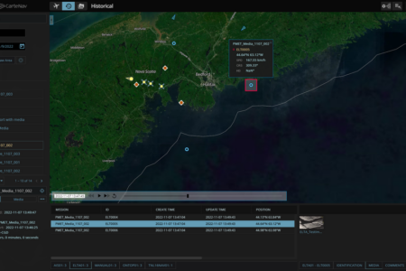
AIMS-C4 is the ground half of the CarteNav architecture: the common operating picture for headquarters, dispatch centres, and operations rooms. It tracks multiple live missions across multiple platform types simultaneously, receives imagery and tracks from every AIMS-ISR-equipped aircraft and vessel in the operation, and archives the results as searchable, evidence-grade mission records.
For agencies running mixed fleets, the ground segment is where platform-agnostic design pays off most visibly: one operations room, one interface, and one data standard, regardless of what is flying.
Vehicle-mounted and deployable installations
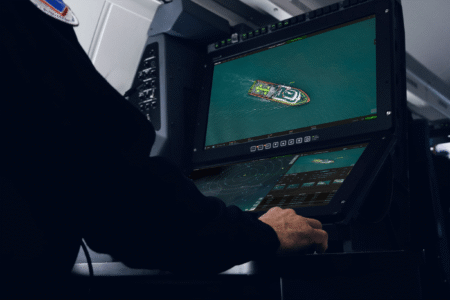
The same software deploys forward. AIMS-ISR and AIMS-C4 installations run in mobile ground vehicles, including protected platforms such as the EAGLE 6×6, in transportable ground stations supporting uncrewed aircraft operations, and at fixed surveillance sites. A deployed command vehicle works from the same georeferenced picture as national headquarters, keeping every level of an operation synchronized.
Mission profiles
- Mobile ground ISR and command-and-control: vehicle-mounted mission systems with the full georeferenced operating picture forward
- Ground-station mission control: transportable stations for uncrewed aircraft operations and sensor exploitation
- Fixed-site surveillance support: ground-based sensor feeds integrated into the same common operating picture