
STAY ON TARGET AND MISSION WITH AUGMENTED REALITY MAPPING

EVIDENCE CAPTURE AND RECORDING IN AN INSTANT

DISPATCH COMMAND & CONTROL IN A COMMON OPERATING PICTURE
Real-time Management Tools for the Entire
ALE Mission
Lifecycle
For real-time ALE operations in the field or mission management back at Command & Control – CarteNav provides C4ISR software covering the entire mission lifecycle.

Intuitive Control for
Multi-Role ALE Operators
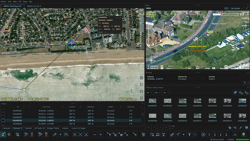
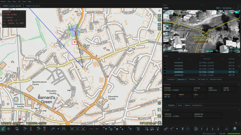
For airborne law enforcement operators, AIMS-ISR provides TacVision overlays, custom map management and instant evidence captures in an intuitive and flexible moving maps interface.
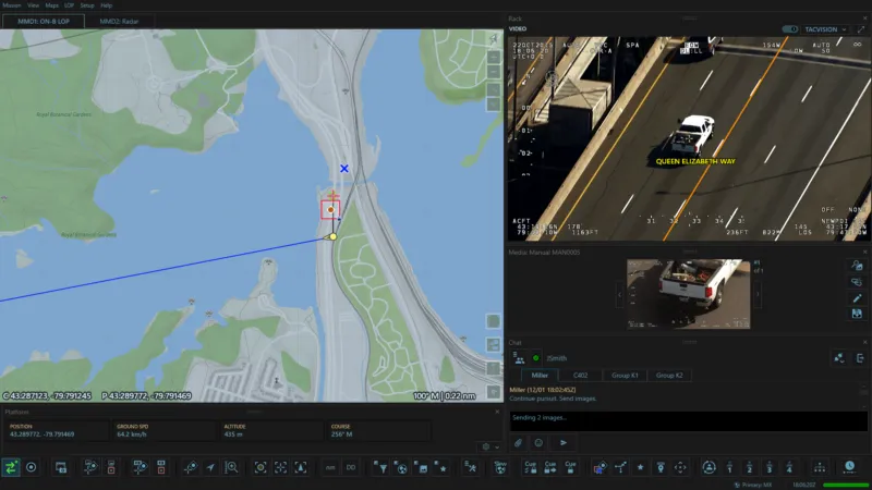
TacVision Suspect Following
Stay on target no-matter what when every second counts. AIMS-ISR moving maps data including POI addresses, street names, AIS, radar tracks and more are geospatially presented on high-resolution EO/IR video. All information is available on a single screen – enabling law enforcement to quickly & accurately report the situation when every second counts.
Instant Evidence Capture & Recording
New features in AIMS-ISR provide the Tactical Flight Officer with tools at the tip of their finger to capture still images, record mission video or capture short video clips during the mission. Every capture is time and date stamped along with additional supporting metadata that provides the continuity of what the crew observed while allowing them to be viewed later and linked back to the original incident.
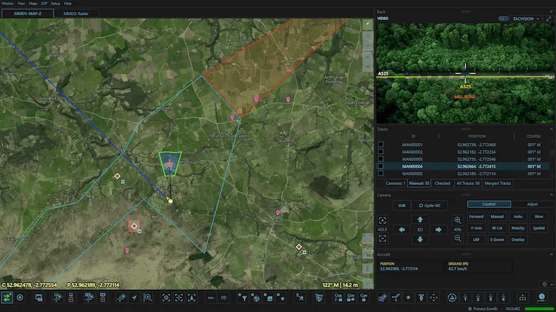
Intuitive Sensor Management
From the Camera to the Searchlight and LoJack Tracker, AIMS-ISR provides the intuitive interface to manage them all. On-screen camera controls and footprint allow the operator to see where on the map the camera is pointing in real-time – providing certainty & situational awareness. Supported searchlights can be geo-locked to independent locations or linked to the camera displaying both in the moving map display. LoJack alerts the operator with an on-screen warning that they can select to start tracking.
ALE Management & Reporting
Upon takeoff, be armed with every detail related to the task at hand. Dispatch-specific POI's, search areas, and other supporting data can be pre-loaded with custom mapping data – providing the crew with the most up-to-date situational picture available. During the operation, additional metadata such as takeoff location, crew details, call signs, and other details are input and logged for comprehensive post-mission reports compiled at the push of a button for consistent evidence reporting.

ALE Mission
Planning & Management
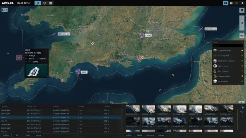
Airborne law enforcement emergency responses are fast-paced and demanding, with each generating vast amounts of information. AIMS-C4 provides a Common Operating Picture (COP) for dispatch while collecting and storing data evidence for review and analysis amongst a distributed team.

Dispatch Command & Control
See the big picture, then action it. AIMS-C4 enables dispatch to view a live Common Operating Picture (COP) with up-to-date locations of every airborne asset along with sensor-data feeds and communication channels. Dispatch operators can re-deploy based on asset locations while seeing real-time data feeds of live incidents – all with the flexibility of a browser-based platform from control rooms, mobile command stations, or even a tablet while on the move.

Exclusive Operator Communication Channel
Armed with the real-time situational picture, dispatch directly communicates with ALE sensor operators. The AIMS-C4 chat interface enables textual and visual media communications. So when the airwaves are busy, the airborne crew can focus and send or receive surveillance-related messages for mission updates or redeployments. This operator/dispatch communication channel avoids confusion, increases the accuracy and speed of data exchange, and allows the aircraft radios to be used exclusively for mission-critical communication.
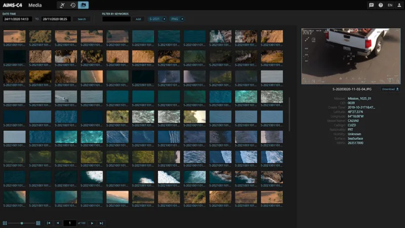
Evidence Archival & Retrieval
Today's ALE operations are volatile and rapid-paced. Daily deployments generate vast amounts of visual evidence data. AIMS-C4 puts historical data to work by allowing airborne law enforcement teams to search based on specific dates/times, geographical areas, as well as any of the mission metadata available, including crew names, aircraft, and base locations. Within seconds, users view the correct mission and viewing media, video, and any reporting tools required to compile mission reports.
Going Beyond ALE
From a single aircraft to managing a diverse fleet or piloted and remotely-piloted airborne assets deployed across an entire country, AIMS-C4 provides the ultimate commercial-off-the-shelf (COTS) solution for multi-mission command and data distribution. No longer tied to a single server and access point for a specific mission type, officers can access data anywhere using the web interface. Users can be managed easily and provided with different permissions restricting access and controls to certain functions making AIMS-C4 the ultimate solution for live viewing or historical mission review for any member of the team.
Customer Case Study
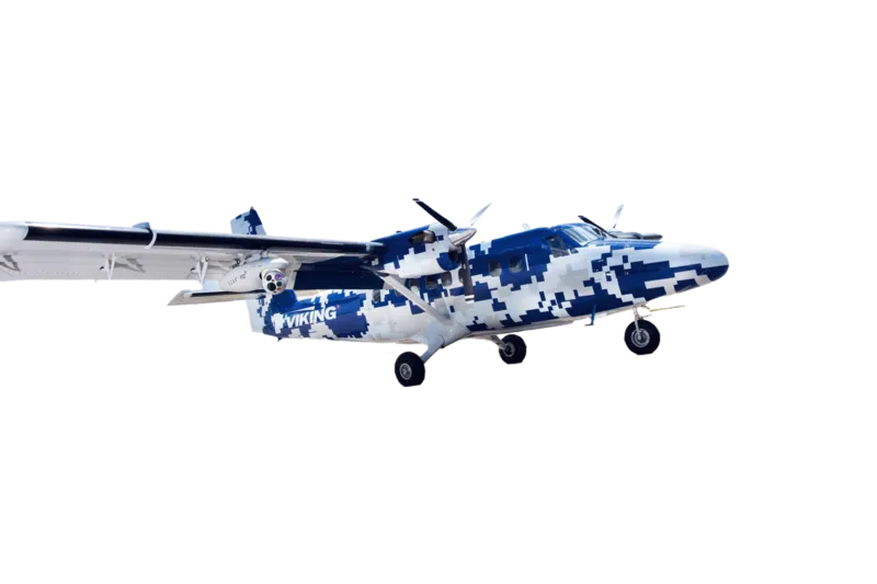
Airborne Technologies
In a world that is becoming more complex, particularly with respect to ISR missions, Airborne Technologies (ABT) is committed to building the highest integrity and efficient solutions available for advanced applications. ABT uses CarteNav’s AIMS-ISR mission system software to equip the aircraft with multi-sensor control capabilities, geo-referenced moving maps, evidence reporting, SIGINT, custom mapping, and more mission optimization solutions.
“CarteNav has specialists and law enforcement veterans on their teams who understand specific mission applications. There’s a high degree of integrity with every installation.”
Wolfgang Grumeth, Airborne Technologies founder & CEO, 27-year law enforcement veteran
Going Beyond the Status Quo
ALE Operator
Situational
Awareness
For real-time operations in the field or mission management back at Command & Control – CarteNav provides C4ISR software covering the entire mission lifecycle.
Challenges Facing ALE Integrators & Operators |
CarteNav C4ISR Mission Software Solutions |
|---|---|
| A limited selection of OEM supported ALE sensors | The flexible plugin-based architecture of AIMS-ISR and AIMS-C4 supports a wide array of cameras, searchlights, LoJack Trackers, radars, and more to execute the force's unique operational needs efficiently. |
| Lack of communication between dispatched ALE aircraft and ground teams. | Real-time chat and sharing of live-incident imagery and videos in a Common Operating Picture (COP) for dispatch and officers on the ground. |
| Single-mission only solutions. | AIMS-ISR and AIMS-C4 make up a versatile Mission Management Suite that can support multi-role operations beyond ALE such as search & rescue, maritime patrol, firefighting, and much more! |
| Lack of custom mapping data for complex urban operating areas and critical infrastructure considerations. | Ability to import custom mission data, including zones, Points of Interest, address database, mapping, routes, and more. |
What's Your ALE Mission?
CarteNav’s ISR Mission software is ready for integration with your ALE operation and chosen multi-sensor configuration – backed by a dedicated ISR support & training team. Schedule a demonstration today and discover the future of Airborne Law Enforcement.
Schedule Demonstration