
Setting the new standard for real-time and historical ISR mission data in a Common Operating Picture.
Manage missions from an intuitively powerful web interface. AIMS-C4 allows real-time communication and data sharing between operators, analysts, and decision makers.
Get Started
Put Mission Data to Work
Inform Decision Making
Command
Utilize historical and 3rd party mission data to expedite planning.
Control
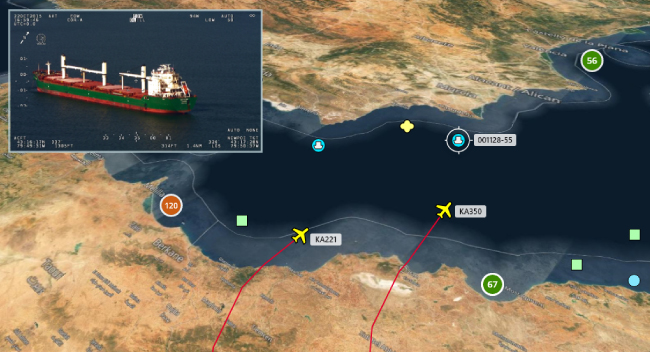
Visualize all deployed platforms within one Common Operating Picture in real-time.
Communicate
Instantly message and share mission data between operators, analysts, and decision makers.
Compute
Operational insights from historical mission data for rapid decision making.
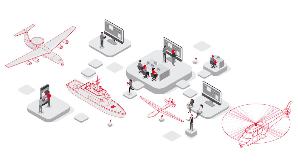
Command & Control
Whether managing platforms in the air, on land, at sea, or all of the above – AIMS-C4 keeps special mission operations in sync and connected.
All Missions. All Platforms.
One Operating Picture.
In addition to historical mission data, all deployed platforms display in a single real-time Common Operating Picture with secure and easy access via a web-based interface. With AIMS-C4, access a complete picture of the day's operations – enabling powerful collaboration & rapid decision making.
Communication from
any Workstation
Sharing and receiving secure mission data is foundational for today’s complex security, safety, economic, and environmental operations. Instant messaging with data sharing keeps crew, and Command & Control operators informed and in control.
Seamless Integration. Real-Time Coordination.
MissionLink is the integration hub within the AIMS-ISR and AIMS-C4 suite, enabling secure, real‑time data exchange across air, land, sea, and satellite platforms. It enhances overall mission efficiency and reduces integration complexity—no matter the environment.

At a Glance
-
Command & Control
- Real-Time Asset Tracking & Management
- Custom Map Layers
- 3rd Party Data Integrations
-
Communication
- Instant Messaging
- Browser-Based Cloud Access
- Agency-Level Permissions
- Multi-User Simultaneous Accessibility
-
Data Management
- Secure Data Storage (imagery, video, metadata)
- Geospatial & Contextual Archive Search
- Graphical Area Vectors
-
Ease of Integration
- Hardware & Mission Management System Agnostic
- Intuitive & Easy-to-Learn Interface
- COTS C4ISR Software
Mission Data Management
Securely store all mission data, including imagery, video, radar data, metadata and more. Once saved, mission data is organized and readily searched by narrowing results by keywords, time, geographical boundaries, and other metadata, all presented in an interactive map with visualizations of found mission data.

Command & Control with AIMS-C4
Put your mission data to work for efficient planning and data management. Our team will provide a custom demonstration and guidance for deploying AIMS-C4 for your unique Command & Control process.
Schedule a Demo