Spot Everything in Detail with Intuitive Auto Sensor Control
Get the Full Maritime Picture with Multi-INT Processing
Increase Situational Awareness with AR Mapping
Real-time Management Tools for the Entire
Maritime Surveillance Mission
Lifecycle
For real-time Maritime Surveillance operations in the field or mission management back at Command & Control – CarteNav provides C4ISR software covering the entire mission lifecycle.

Intuitive Control for
Multi-Role Maritime Surveillance Operators
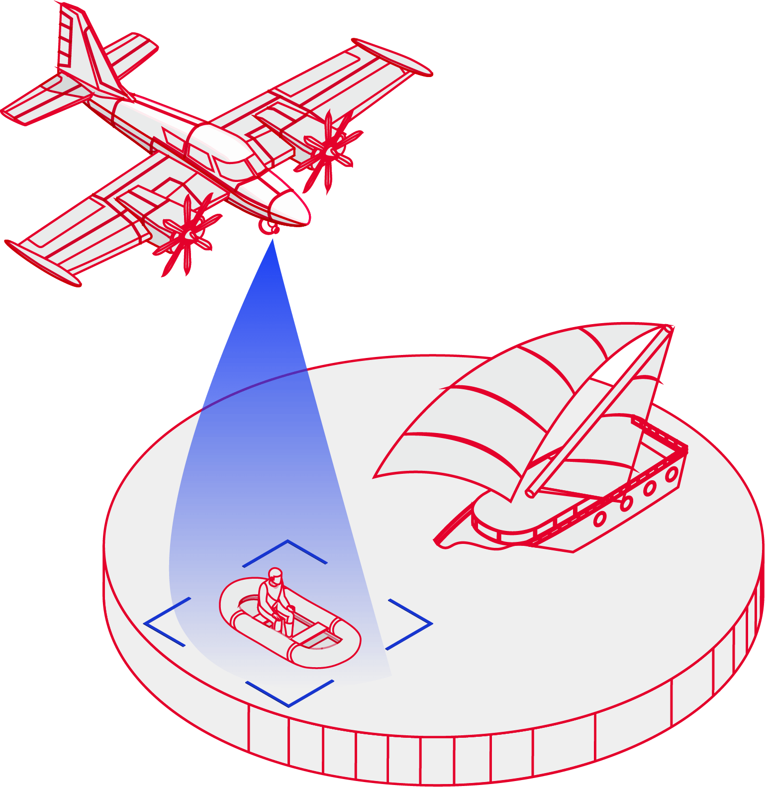
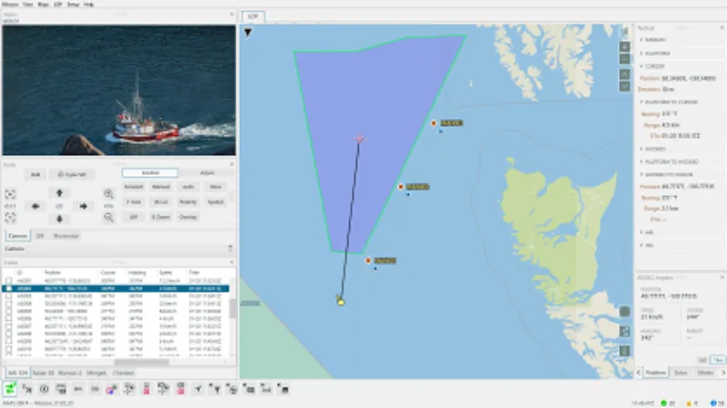
For maritime patrol operators in the field, AIMS-ISR provides augmented reality EO/IR inspection with multi-mode radar surveillance, vessel tracking, threat assessment, target filtering, and other patrol tasks – all in an intuitive and flexible moving map interface.

AR Vessel Inspection
Harness all intelligence streams with a single press. AIMS-ISR moving maps data such as ship-based AIS tracks, ADS-B, and radar targets are geospatially presented on high-resolution EO/IR video feeds. All information is available on a single screen – enabling operators to quickly & accurately gather information when every second counts.
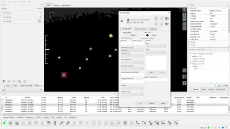
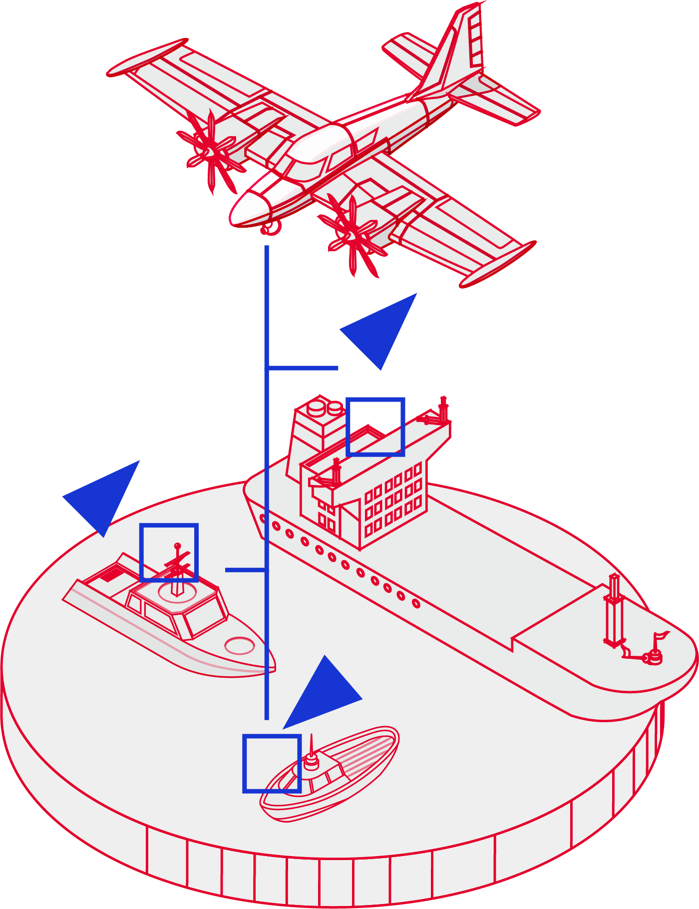
Vessel Classification Tracking
Friend or foe? Using NATO Standard 2525 symbology enables operators to classify vessels as Targets of Interest (TOI) or RefMark Points of Interest Affiliation. Additionally, configurable track statuses inform current or future crews of which vessels have already completed processing.
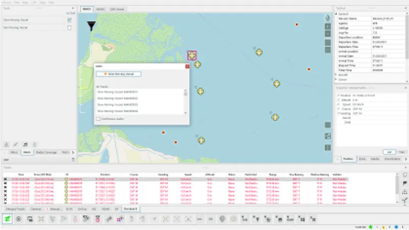
Moving Maps Alerts & Filtering
Increase operator situational awareness with custom alerts and filter rules. Smart filters are a powerful tool for removing irrelevant vessel tracks on the movings maps and EO/IR overlays. These custom rules allow operators to ask, "show me only vessels that are moving faster than 10km/hr". Or, "alert me when a vessel enters a set Exclusive Economic Zone."
Intuitive and Easy to Use
AIMS-ISR is built with ease-of-use and maximum situational awareness so operators can monitor and report on numerous vessels in a single mission without strain. Rotating maritime patrol crews with no previous system experience can quickly become proficient with minimal training.

Maritime Surveillance Mission
Planning & Management
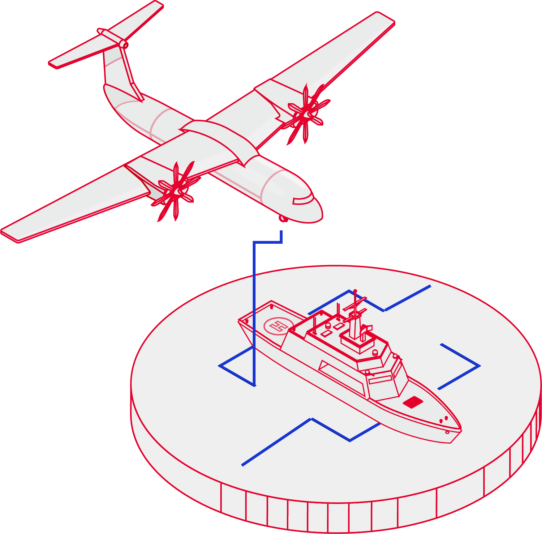
Surveilling a nation's Exclusive Economic Zone (EEZ) and sovereign coast waters generate vast amounts of data. AIMS-C4 stores and manages that surveillance data in one Common Operating Picture (LOP) – turning maritime data into actionable & accessible information.
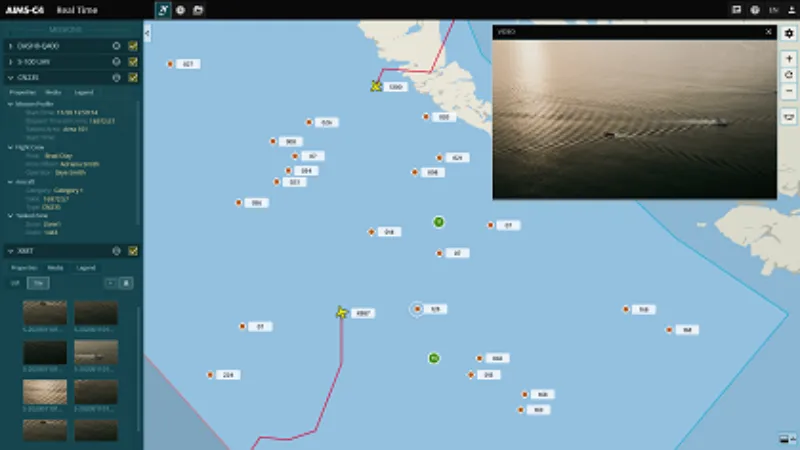
All Operators. All Vessels. One Picture.
Manage maritime surveillance in the air while feeding information to commanders on land or sea. AIMS-C4 is a single real-time Recognized Maritime Picture (RMP). Teams access this RMP on any device via an intuitive web-based interface for rapid decision-making and maximum maritime domain awareness.
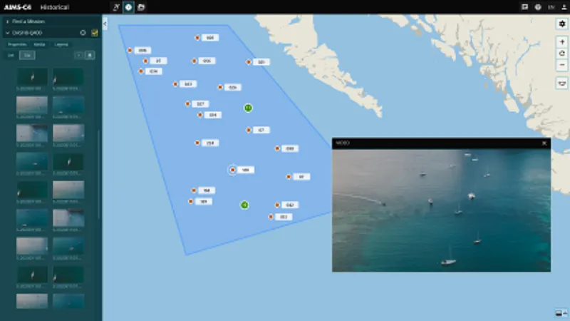
Put Historical Geospatial Data to Work
Today's maritime operations command vast sea swaths, generating equally vast amounts of imagery and geospatial vessel data. AIMS-C4 securely stores all gathered data to allow users to ask, "how has the maritime picture changed day by day?" Or, "when was the last time this area was patrolled and by whom?" Or "show me incident imagery and video from this specific mission for further analysis."
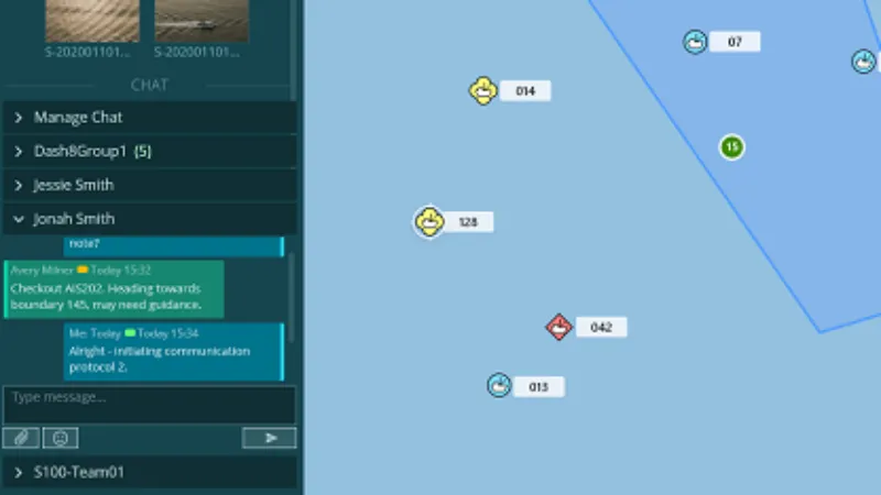
Real-Time Communication
Commanders have a direct communication line to maritime patrol operators in the sky. Live-chat, media sharing and report generation enable coordination of search & rescue, pollution events, counter-smuggling, defence, and more. With secure agency-level permissions, AIMS-C4 is fully interoperable with coalition partners or other civilian/governmental agencies.

Flexibility to Go Beyond Maritime
AIMS-C4 is a flexible multi-INT platform configurable for operations beyond maritime surveillance such as law enforcement, force protection, firefighting, surveying, and much more. This flexibility is at the core of the complete mission lifecycle – ensuring every operator, platform, and sensor is maximized.
Customer Case Study
Heliwest Group
Located on Australia’s rugged west coast, Heliwest achieves ISR excellence for multiple special mission types. Missions include fire mapping, search and rescue, and linear surveillance – all executed using one common ISR mission system: AIMS-ISR.
“AIMS is critical to all our sensor payload missions. It’s the brains behind those missions. It helps us win many contracts we would not be able to compete for otherwise. It gave us the confidence we could go after those tenders and deliver on the specifications, knowing AIMS-ISR wasn’t going to cause us any trouble along the way. We know it’s going to be there, and it’s going to work.”
Tim Hand, Manager of Special Projects, Heliwest
Going Beyond the Status Quo
Maritime Surveillance Operator
Situational
Awareness
For real-time operations in the field or mission management back at Command & Control – CarteNav provides C4ISR software covering the entire mission lifecycle.
Challenges Facing Maritime Surveillance Integrators & Operators |
CarteNav C4ISR Mission Software Solutions |
|---|---|
| A limited selection of OEM supported Maritime Patrol Aircraft (MPA) sensors. | The flexible plugin-based architecture of AIMS-ISR and AIMS-C4 supports a wide array of radars, EO/IR cameras, ViDAR, SIGINT receivers, and more. |
| Lack of communication between airborne Maritime Patrol Aircraft and commanders on the ground. | AIMS-C4 enables real-time chat and a shared understanding of the Recognized Maritime Picture for commanders, coalition partners and other civilian/governmental agencies on the ground. |
| Limited single-mission capabilities. | AIMS-ISR and AIMS-C4 are flexible and support multi-role operations concurrently with maritime surveillance such as search & rescue, firefighting, law enforcement, force protection, border surveillance and much more! |
| Lack of custom mapping data for complex waterways and economic zones. | Ability to import custom mission and mapping data, including Economic Exclusion Zones (EEZ), routes, Points of Interest, and more. |
What's Your Maritime Surveillance Mission?
CarteNav’s ISR Mission software is ready for integration with your Maritime Surveillance operation and chosen multi-sensor configuration – backed by a dedicated ISR support & training team. Schedule a demonstration today and discover the future of Maritime Surveillance & Control.
Schedule Demonstration